Trail #3: Hiking Trails Southeast of Baumholder: Bärenbachpfad and Gärtel

Trails #3.1 to 3.7. Hiking Trails Southeast of Baumholder: Bärenbachpfad and Gärtel

By Dr. Mike Bowers ~ drmikebowers.guide@gmail.com

To see the photos in a full-page format, open a new tab and direct your browser to: https://photos.app.goo.gl/lmltZv7FB68h9jyy2

“NOT ALL WHO WANDER ARE LOST.” ~JRR Tolkien

Fields of ‘Rapssaat’ flowers announce the arrival of spring on the southwest sector of the Bärenbachphad hiking trail.
Late winter snow on the first kilometer of the Gärtel Road.

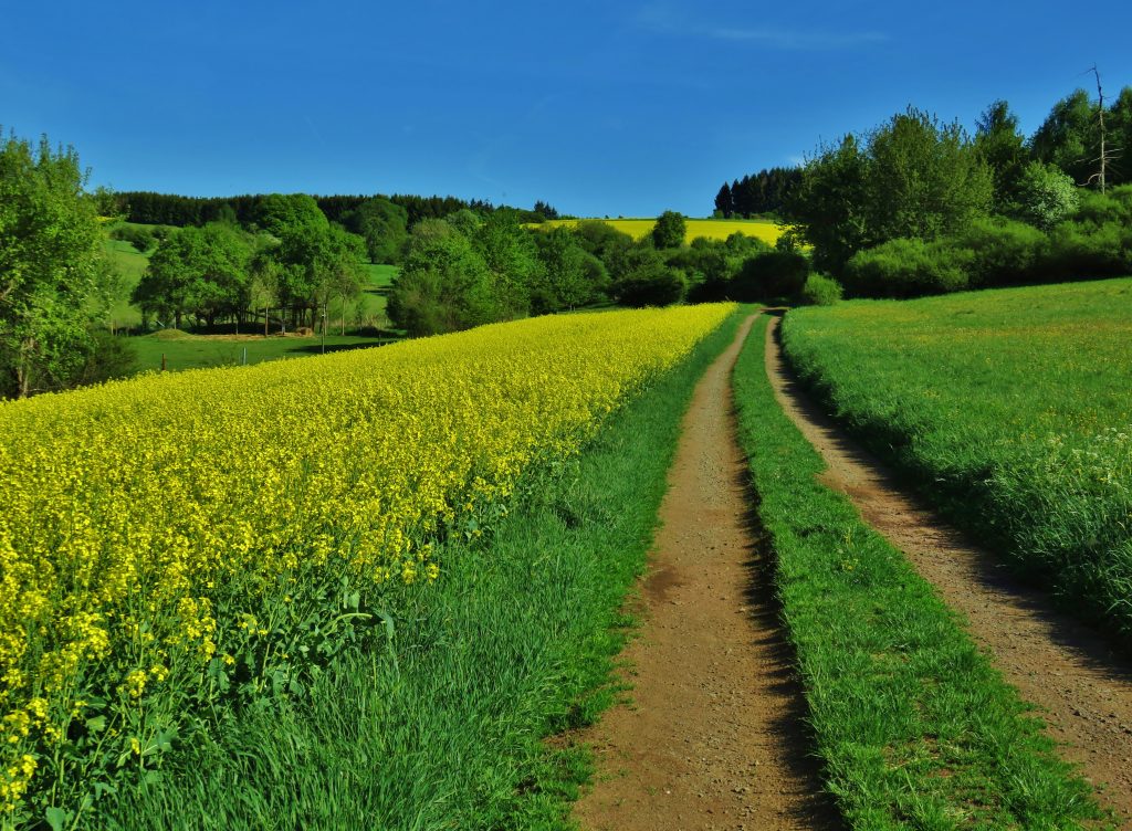
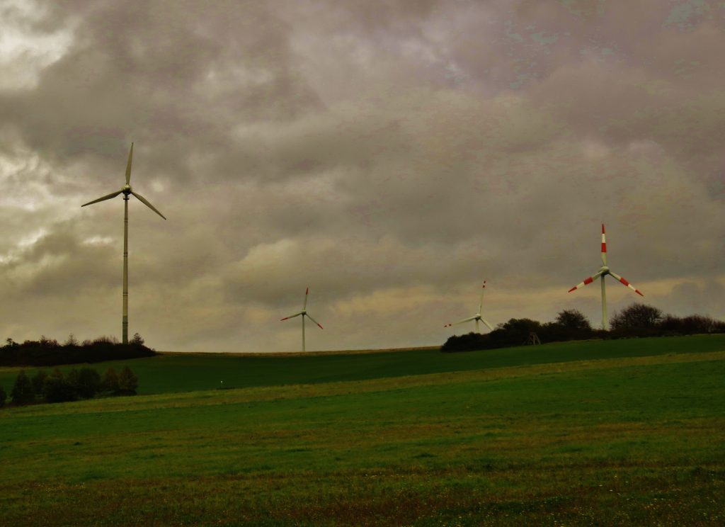
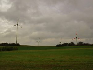
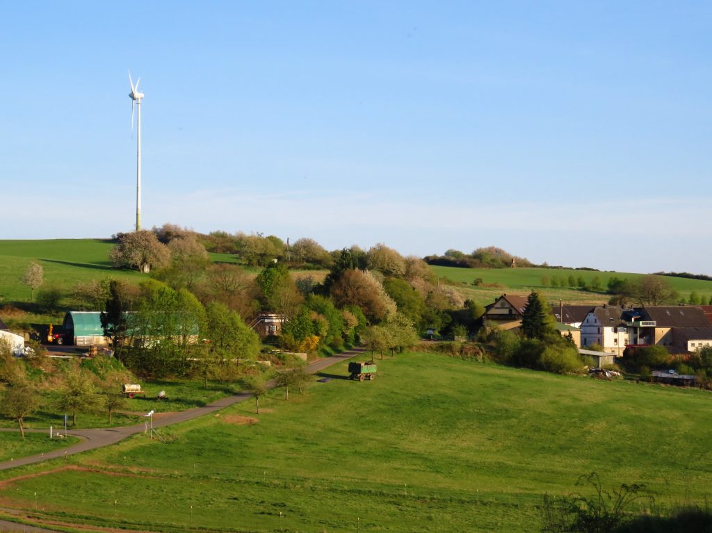
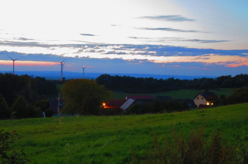
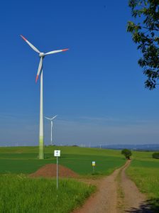
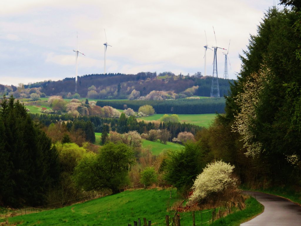
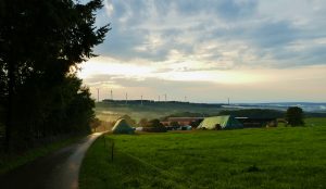
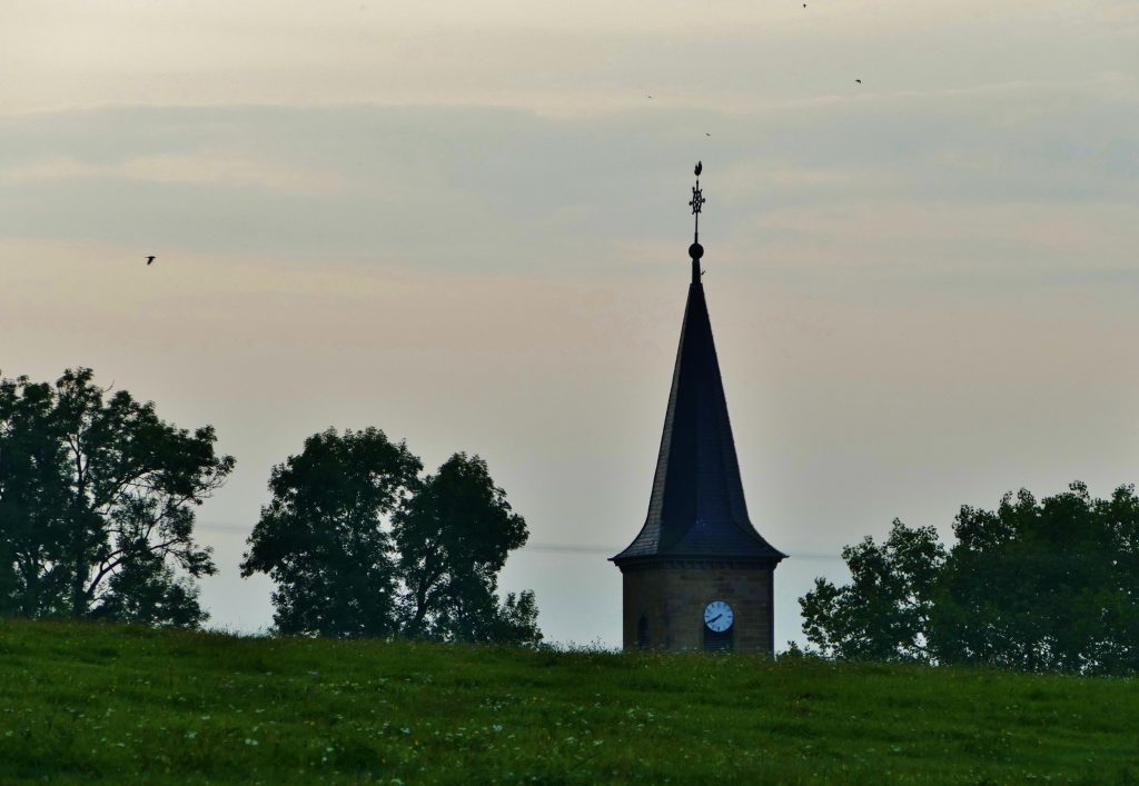
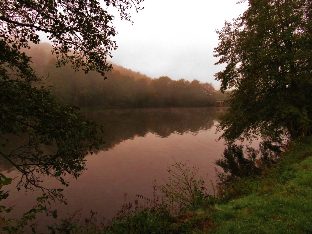
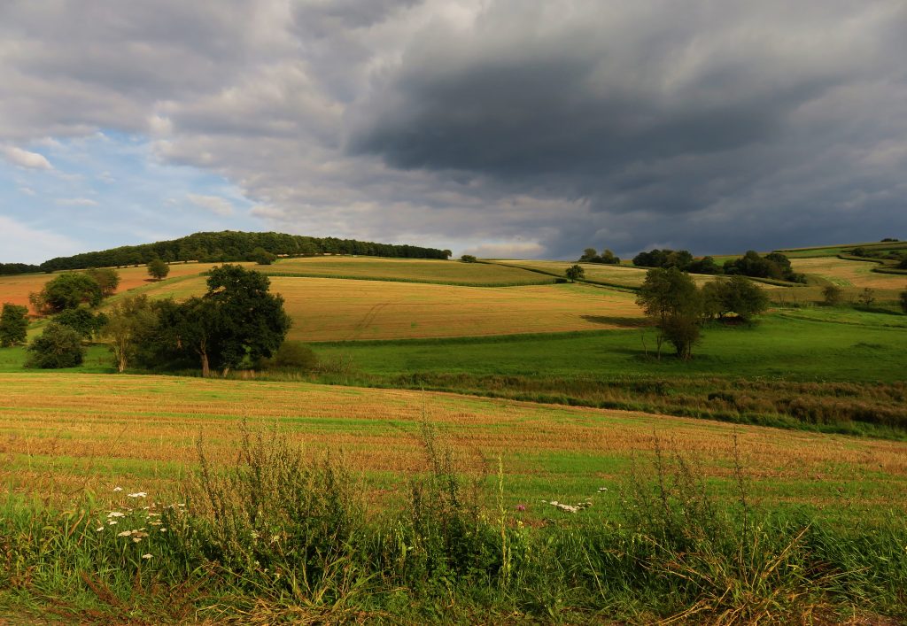
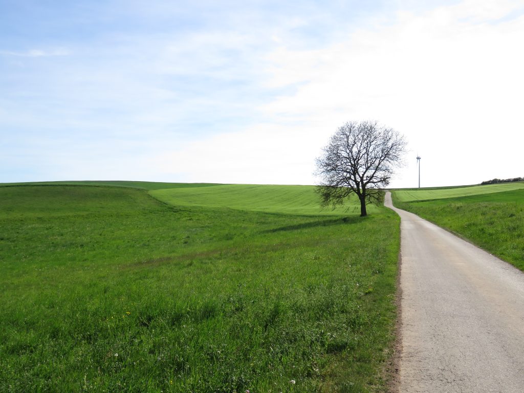
Just beyond the edge southeastern edge of Baumholder, the Gärtel area is a great ‘go-to’ when we need a quick escape to the serenity and quiet of nature! Gärtel is the name for a large tract of hilltops, woods and meadows brimming with natural beauty and outdoor learning opportunities for walkers and runners.

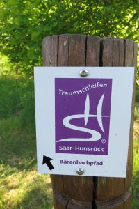
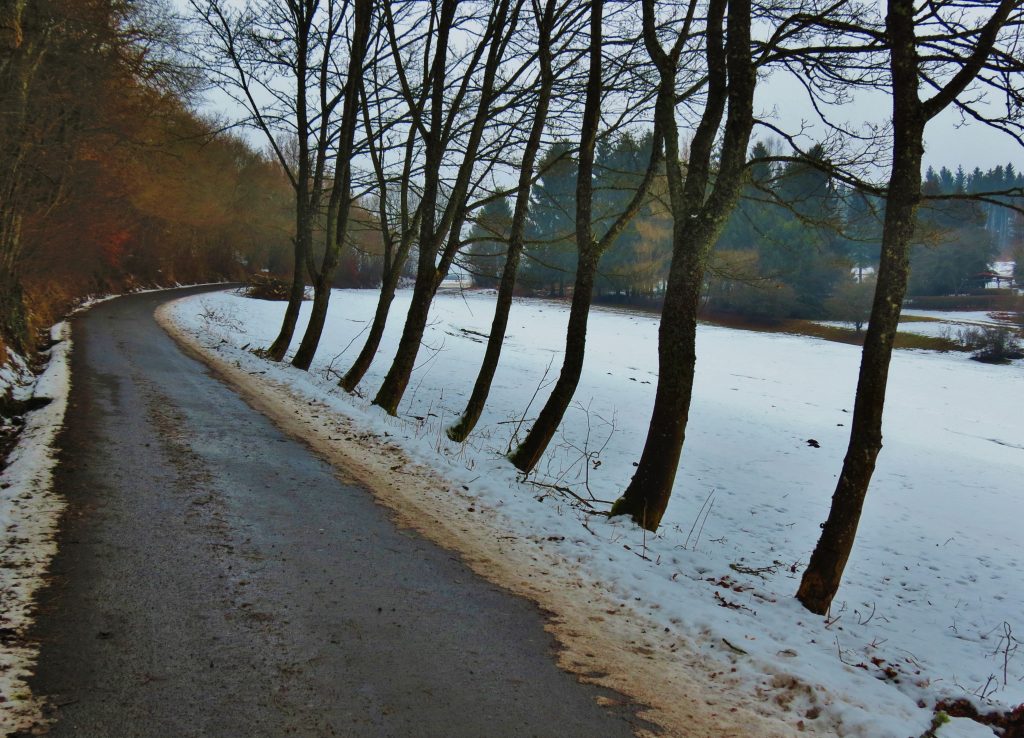
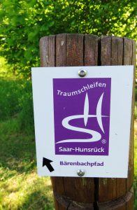
The 14k Bärenbachpfad (Bear Creek Trail) is the only major regional designated hiking trail in the Baumholder vicinity. (‘pfad’ means ‘trail.’) The Bärenbachpfad circumnavigates the expanse of the Gärtel area. The trail is open to mountain bicyclists, but requires real mountain bike skills and stamina for rough trails and steep slopes.

We will explore a variety of hikes/runs in this area which range for 2k to 14k in length.

Finding Gärtel

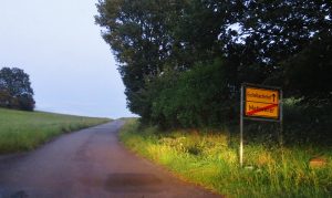
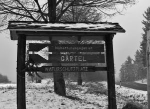
To find Gärtel, begin on the south edge of Baumholder at the intersection of the Ringstraße and Highway L-176; the highway which heads south toward Kusel. (The shop “Kik” sits on this intersection.) Take the highway uphill for about .5k and watch for a paved road on the left. A wooden sign ‘Gärtel‘ sits at the intersection.

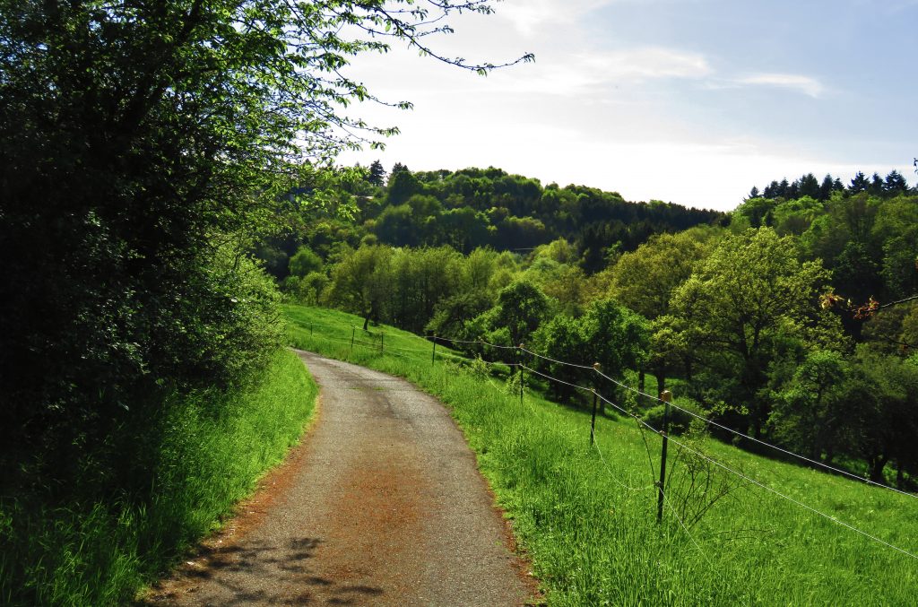
Turn here and park in the parking lot just past the intersection. The paved one-lane road continues through pleasant woods for 1k to a second parking lot, which provides easy access to loops through a nature education center.

ROUTE SPECS

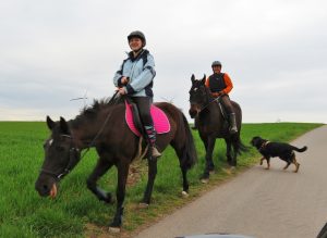
Type of trail: Designated hiking trail and area route options; hiking / running; mountain bikes or sturdy hybrid bikes are great for all these trails – except the very steep section between Waldhaus and Wildfrauenloch (see Trail 3.5.)

Trail name: Trail #3: Bärenbachpfad and Gärtel routes #3.1. – 3.7.

Location: 1k southeast of Baumholder, Rheinland-Pfalz, Germany

Length: Unlimited length options. The area features a 14k designated hiking trail and numerous hiking/bicycling/running options/nature appreciation opportunities!

Challenge: Climbing up-hills / Rewards: Down-hills! Great workouts! the serenity of nature, verdant views!

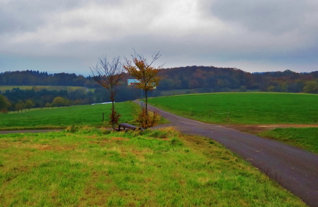
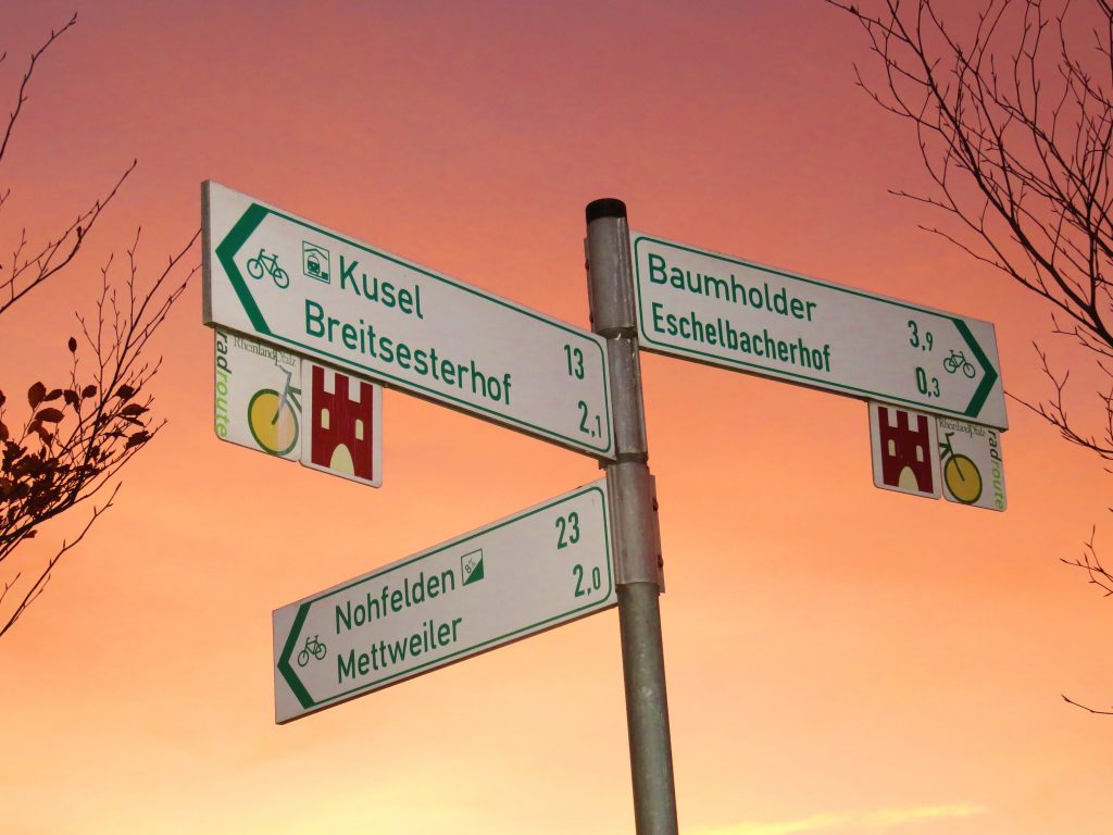
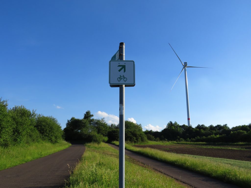
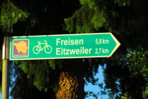
Route-finding: Easy. The Bärenbachpfad is very well signed.

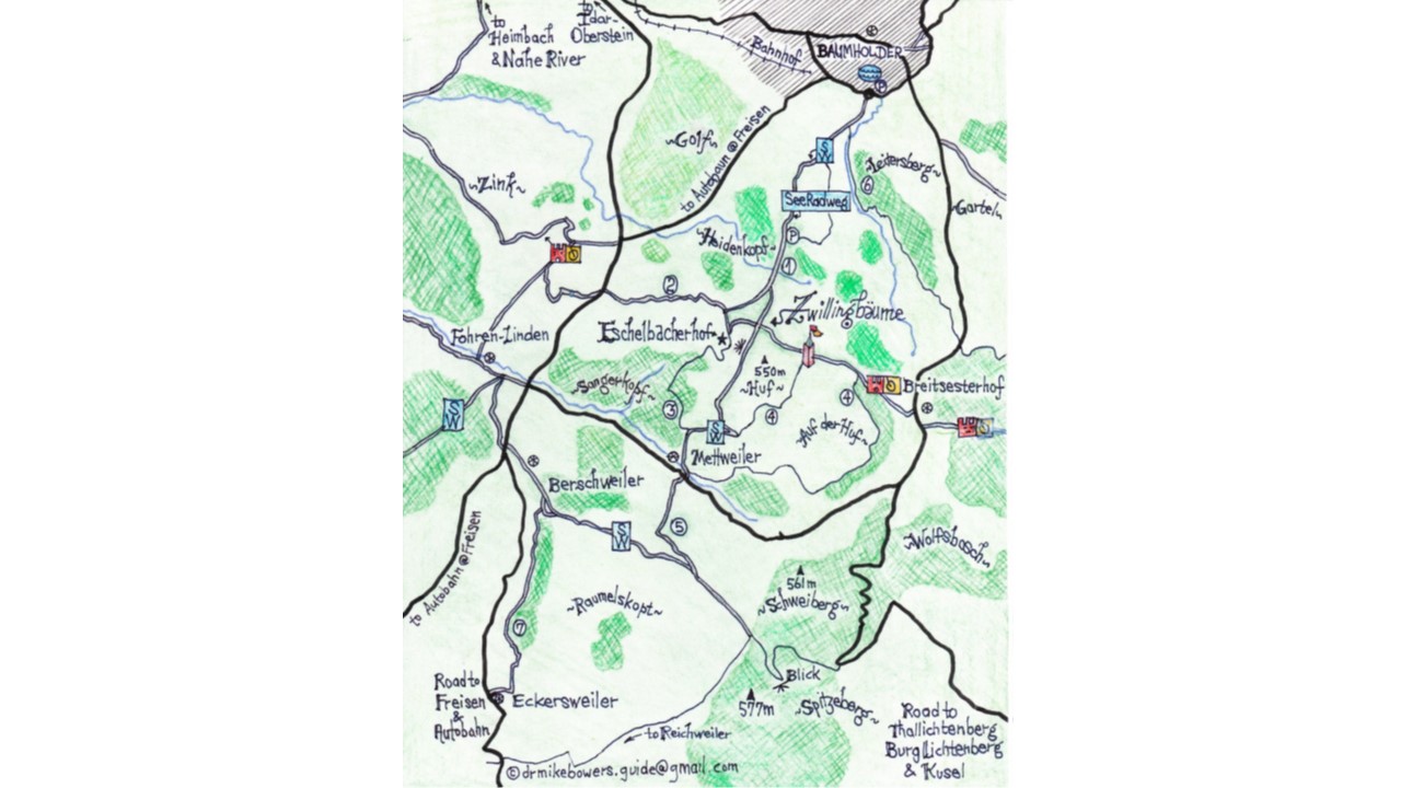
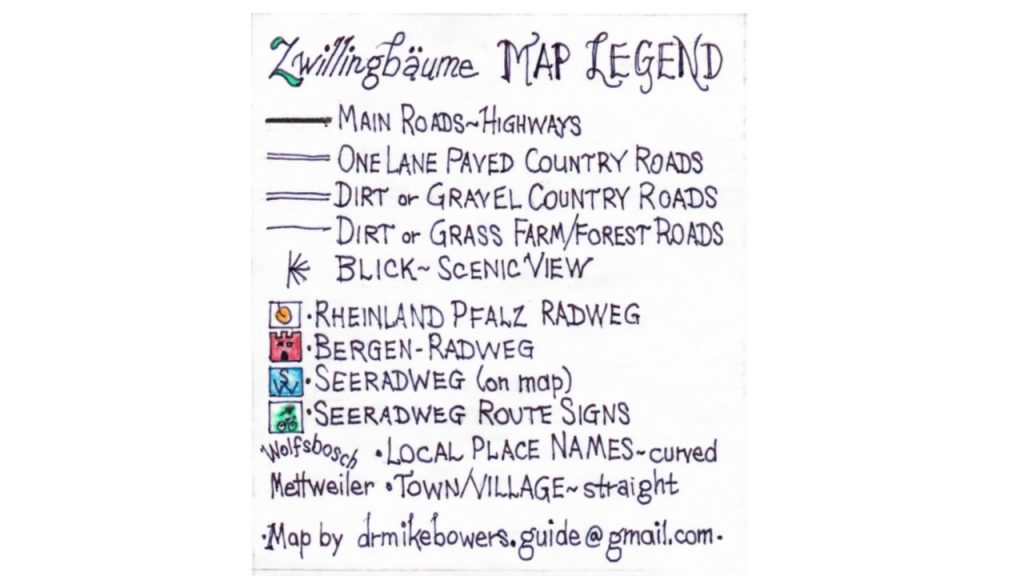
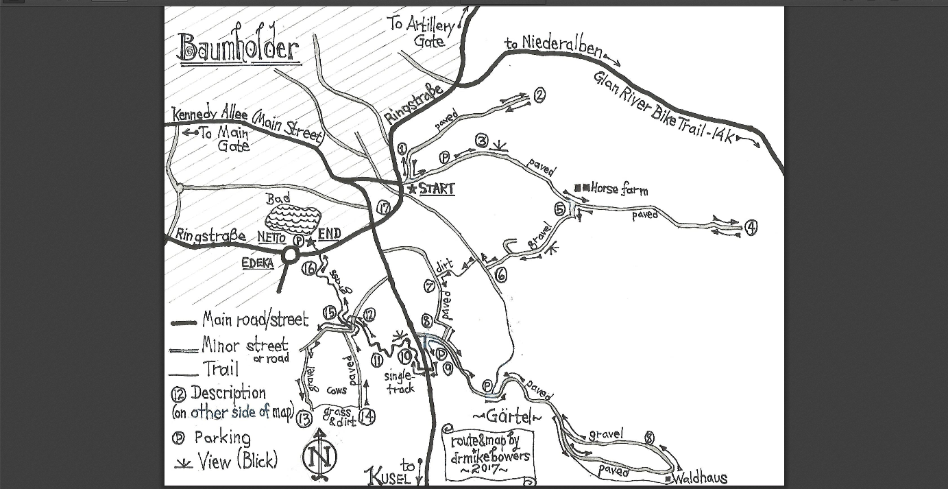
Tip: Download and print my map of the area (or open it in a new tab on your browser).

Highlights: woods, pastures, scenic views, nature conservation education center

TRAIL DESCRIPTION

See circled numbers on map which correspond to the descriptions of the seven suggested trails.

Please print the map (or open it in new tab). You will have a deeper understanding of the trail descriptions if you follow along on the map as you read. Use your mind’s eye to envision the terrain – excellent exercise for your brain!  ~DrMike

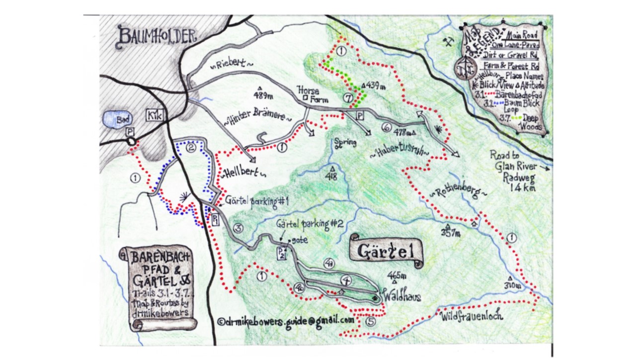
Printable map of Bärenbachpfad & Gärtel (PDF):  Bärenbachpfad.map.v4.

Note: There are dozens of unpaved forest roads throughout this area. The map shows the discussed roads and trails – and does not show minor forest roads unless it provides a useful option in personalizing the routes.

Trail #3.1. Bärenbachpfad – 14k Designated Hiking Trail

The Bärenbachpfad – Bear Creek Trail – is clearly marked with signs. Relax, no bears currently live in the area!

The Bärenbachpfad is very well signed and easy to navigate.

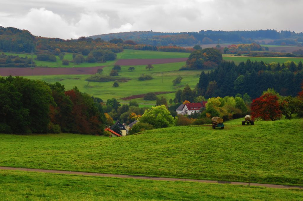
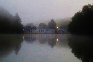
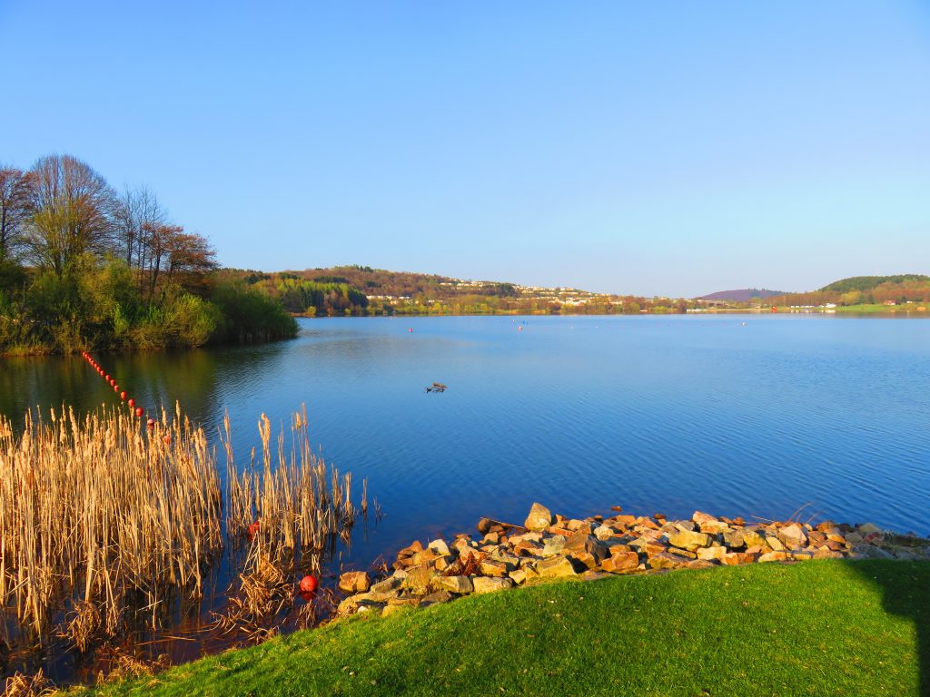
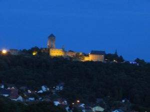
The Bärenbachpfad officially begins at the Baumholder Bad/Lake Park in the park’s parking-lot near the Netto grocery (on the Ringstraße in Baumholder). Across the parking-lot from the lake, a tall wooden gateway announces the Start of the Bärenbachpfad. The trail immediately crosses the Ringstraße and passes the edge of town, climbs the upsloping green pastures, takes in a great ‘blick’ (viewpoint) of Baumholder town, then crosses the highway and continues into the Gärtel area. At Gärtel parking-lot #1 (near the highway), the Bärenbachpfad forks into a loop trail.

This type of trail is a ‘lollipop’ trail (see the red dots outlining the trail on the map). The first section – 2k – of trail from Baumholder Bad (Lake) Park to Gärtel is a single trail, then, at the first Gärtel parking lot the trail splits and heads into the woods in two directions, which eventually meet to form a 10k loop.

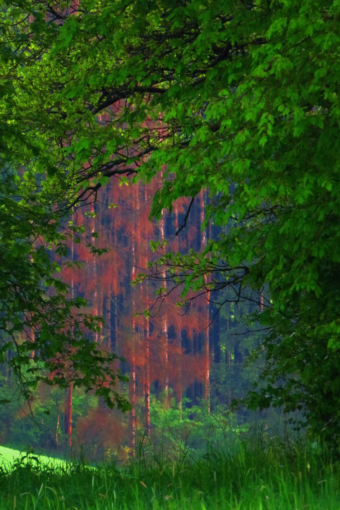
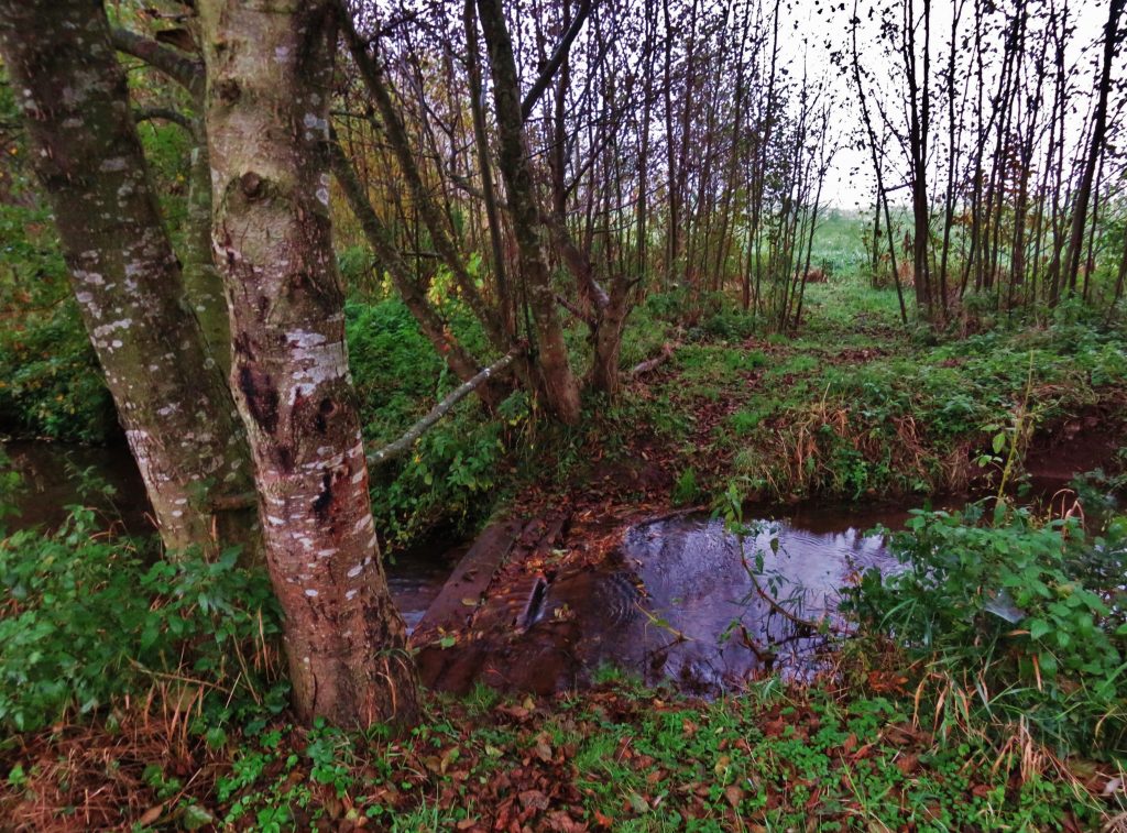
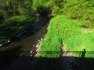
Heading south on the Bärenbachpfad from Gärtel parking lot #1, the trail crosses woods and meadows for several kilometers, then the path drops from the high moors and forests down into the narrow, scenic canyon of the Bärenbach and follows the cascading creek downstream before following the Auerbach upstream and uphill to the hilltops of Gärtel.

The length of the entire Bärenbachpfad is 14 kilometers. The Bärenbachpfad trail is part of the ‘Traumschleifen Saar-Hunsrűck’ trail system in the adjoining states of Rheinland-Pfalz and Saarland. (Traumschleifen Saar-Hunsrűck means ‘picture-perfect loop hikes in the Saar-Hunsrűck region.’)

TRAIL SECTORS OF THE BÄRENBACHPFAD – detailed descriptions follow:

~ Trail #3.2. is a 2k loop hike, beginning at the edge of Baumholder, which includes some of the most scenic sections of the trail.

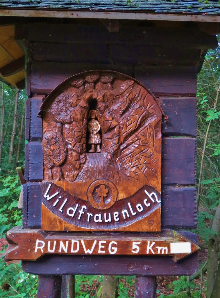
~ Trail #3.5. follows a steep sector of the trail downhill to the cliff-lined mossy canyon of the Bärenbach known as Wildfrauenloch.

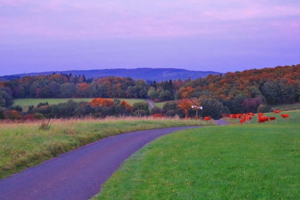
~ Trail 3.6. is a short hike through fields and meadows to a sector the Bärenbachpfad with a fine blick (viewpoint) over the Totenalb River valley.

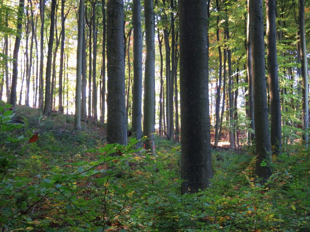
~ Trail 3.7. follows a short section of the Bärenbachpfad through a section of old, deep hochwald (hilltop forest).

Trail #3.2. Baum Blick Loop of the Bärenbachpfad (Hike, Run, Bike)

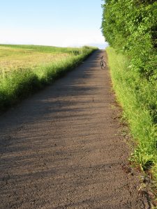
This short 2k loop trail – for hiking, running, or bicycling – features some of the most scenic sections of the Bärenbachpfad trail and is easily accessible from the town of Baumholder. This route has a steep hill but is fine – and fun – for bicycles.

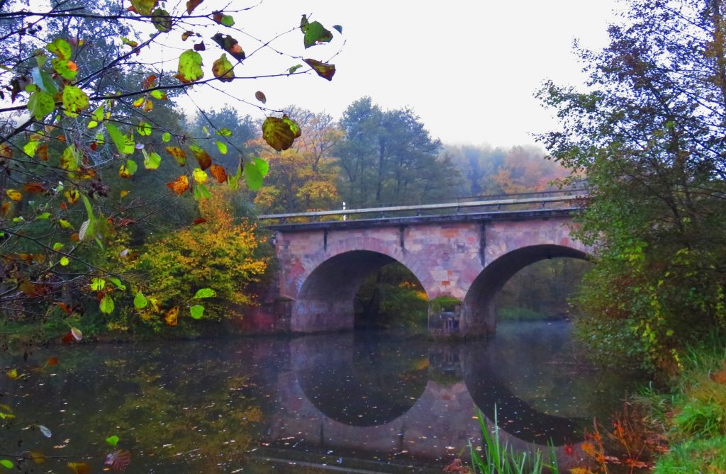
The best place to begin this loop is at Gärtel parking lot #1. From the parking lot, the well-signed trail parallels the highway heading south, then crosses the highway (Cross carefully! High-speed traffic!), continues through woods – then suddenly – a money-shot view of Baumholder town, distant hills and valleys. The trail follows the edge of a broad meadow downhill – a blast on a bicycle! -to a paved one-lane road. Take a right on this road and follow it back to the highway. At the highway, turn left and walk along the highway for about .2k/200 yards and take the one-lane paved road on the right which heads uphill and curves to the right, eventually looping back to the Gärtel parking lot #1. (Be very careful walking along the highway – high speed traffic!)

This loop is about 5k/3 miles.

One could also begin the loop walk at the Bad Park parking-lot making the trail a ‘lollipop’ loop; this adds about 1k to the loop.

Trail #3.3. The First Kilometer of the Gärtel Road

The Gärtel road is a scenic paved one-lane road with very little traffic. This 2k out-and-back walk begins at Gärtel parking-lot #1 and follows the Gärtel road into a valley, across a small creek, and climbs to a flat area with Gärtel parking-lot #2. Turn around here and retrace your route for a 2k walk, or combine this with Trail #3.4. and continue walking/riding past the gate on the paved road to enter the Naturschutz-platz (nature conversation education area).

Friendly horses usually pastured near the Gärtel parking lot #1.

Trail #3.4. Naturschutzplatz and Waldhaus

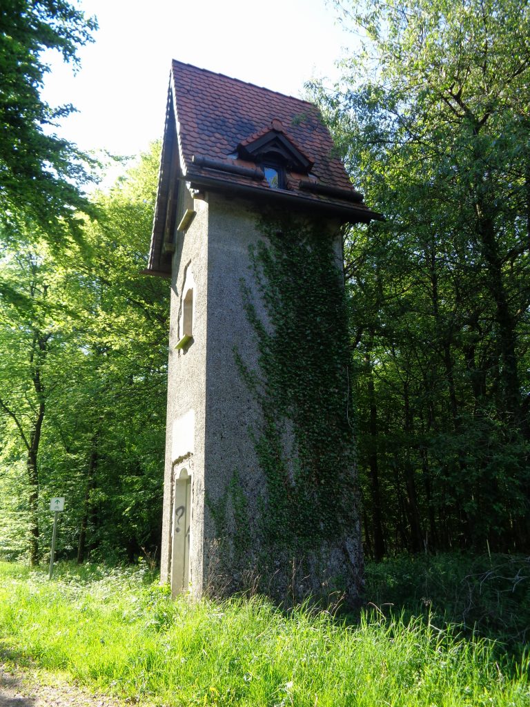
At Gärtel parking lot #2, the paved road is gated. Walk or bicycle around the gate and continue on the paved road for 1k. You have entered the Naturschutz-platz (nature conservation education area) which features display boards detailing the flora and fauna of the local forests. All the boards are in German (perhaps take your German-speaking friend for a walk?), but the displays are worth viewing. For example, one board shows drawings of birds typical to the forest.

The ‘picknick’ gazebo at Waldhaus. Plan to stop here for lunch or a snack on the way back – after you have climbed up from the canyon!

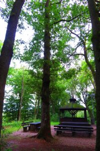
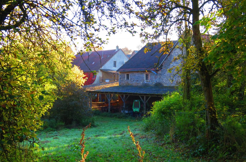
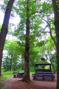
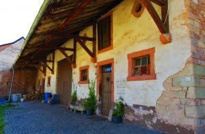
The paved road ends at a T-intersection beside the Waldhaus (forest house), which is a nice picknick and outdoor event area. Dirt roads go to the left (Trail #3.4.a.) and the right (Trail #3.4.b.). All three roads in the area feature nature education boards along the trail. The trail to the right is recommended (Trail #2.4.b., the southernmost road in the loop). Along this section of trail, a small hűtte/hut displays the varieties of birdhouses – each tailored to their tiny residents’ housing needs. Listen for their sweet birdsong!

Follow the roads around to where they meet up with the paved road and retrace your steps to Gärtel parking lot #2.

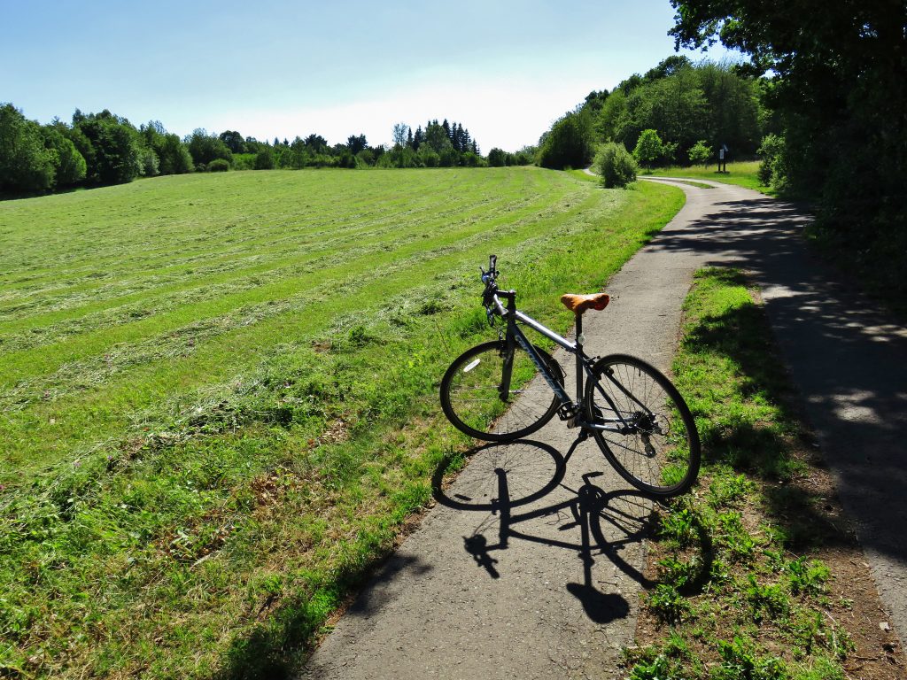
The stretch of Gärtel Road from Gärtel parking-lot #1 to Waldhaus is ideal for bicyclists of all ages – mostly paved roads, mellow hills, deep woods, few autos. ~DrMike

Trail #3.5. From Gärtel parking lot #2 to Wildfrauenloch – out-and-back

This 5k hike leads to the most dramatic scenery on the Bärenbachpfad loop trail – Wildfrauenloch – the cliff-bound, mossy canyon of the Bärenbach.

At the Gartel parking lot #2, this cool sign marks the beginning of the 5k out-and-back hike to Wildfrauenloch. The sign illustrates the local folk legend of a ‘crazy woman’ (wildfrauen) who shared a cave with a bear. The cave can easily be found among the canyon cliffs at the end of this fine hike. Rundweg = hiking trail.

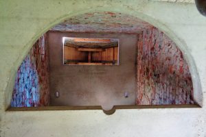
The hike begins at Gärtel parking-lot #2. Round-trip trail length from Gärtel parking-lot #2 to Wildfrauenloch is 5 kilometers/3 miles. Follow the paved road to Waldhaus – about 1k. Upon reaching the T-intersection at the Waldhaus and picknick pergola (see photo, Trail #3.4), turn right and follow an unpaved road (the beginning of Trail #3.4.b.) about 50m/50yds.

Watch for the Bärenbachpfad and Wildfrauenloch signs and the trail intersection on the left. Follow this trail downhill for a short distance to a nice blick (viewpoint) overlooking the valley below.

Follow the well-signed trail down switchbacks into the canyon of the Bärenbach. Since this section of the trail is very steep, bicycles are not recommended.

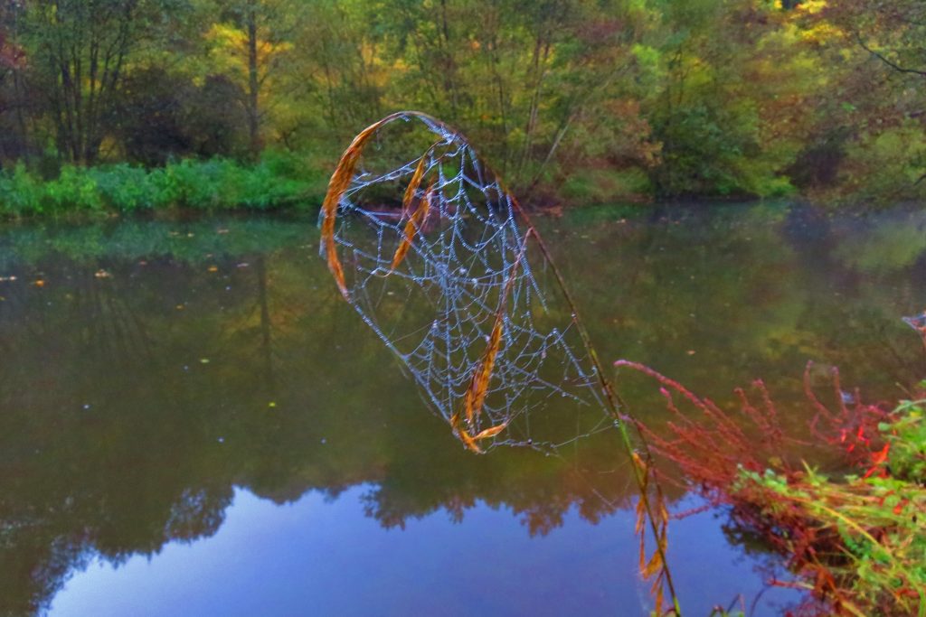
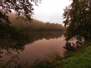
The creek tumbles over small waterfalls and cascades below mossy rugged cliffs. Wildfrauenloch is named after the local legend of a ‘hermit woman’ (wildfrauen = feral old woman) who lived in a prominent rock cave in the canyon (loch means ‘hole’ as in a narrow canyon). Legend tells of the woman being surprised by a bear who planned to hibernate in the cave. The story is that she and the bear both lived in the cave. You will see their small fissure cave on the south side of the creek?

If you wish, follow the trail and canyon downstream to where the Bärenbach joins the Auersbach (bach means ‘creek’) – the lowest elevation of the trail – where it continues upstream along the Auersbach and eventually climbs back up to the hilltops to complete the loop. Go as far as you wish, then retrace your steps up the steep slope to Waldhaus and the starting point at Gärtel parking-lot #2.

Or try a GÄRTEL BIATHLON: Starting from Gärtel parking-lot #1 or #2 (or from Baumholder) ride a bicycle to Waldhaus. Park and lock your bike, then follow the section of the Bärenbachpfad that leads downhill to Wildfrauenloch. Explore the area and enjoy a picknick at the creek-side tables. Climb back up the trail to Waldhaus; then complete the route by riding back to your starting point. (Distance to Waldhaus from Gärtel parking-lot #1: 2k; from Gärtel parking-lot #2: 1k; from Baumholder Bad Park to Waldhaus: 3-4k depending on the route; see Trail 3.2 for routes from Baumholder to Gärtel.

How a GÄRTEL TRIATHLON? Start with a thorough muscle stretch sequence – don’t hurry it – before you head out. ~DrMike

Trail #3.6. Barenbachpfad – Northern Sector Hike

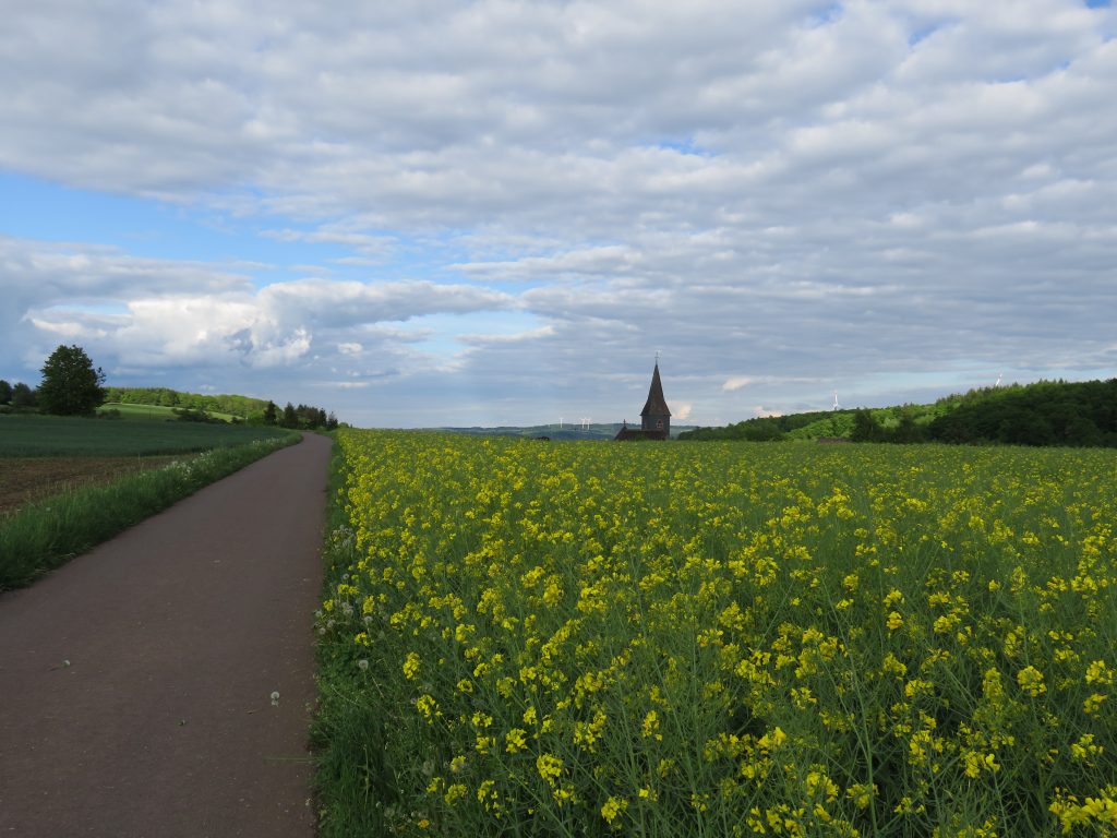
This short family-friendly walk follows a paved road with almost no traffic, crossing meadows and fields to the northern section of the Bärenbachpfad and ends at a fine blick over the Totenalb Valley.

The blick overlooking the Totenalb River Valley at the end of Trail #3.6.

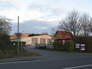
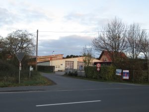
Note: To reach to start of this walk, first locate the road to the trailhead on the map. This country road to the trailhead is a non-descript minor paved road which intersects with the eastern side of the Baumholder Ringstraße. Although there is no street-sign, the street across the intersection is Erzweilerstraße. The road is to the left facing the business sign announcing “Auto Westrich”; look for their big lot of tour busses.

~ Detailed directions to this road are provided in the Trail Description of Trail #1.  ~

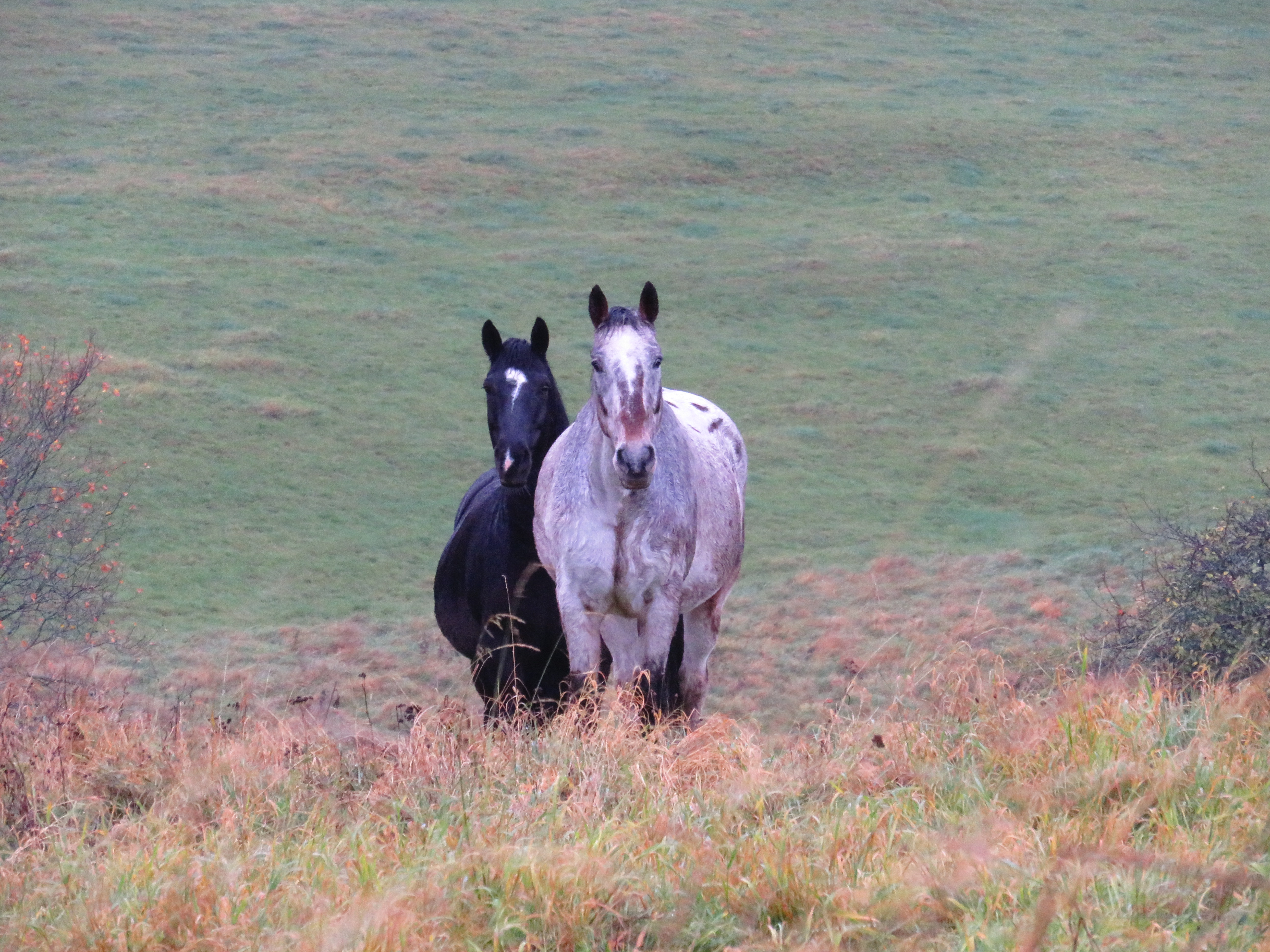
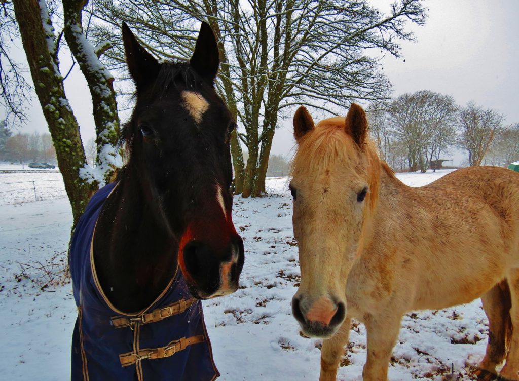
Drive the road, climbing gradually uphill past the edge of town; at about 1k the road passes a horse farm on the left. Continue until the road forks to the right and the paved road continues straight on.

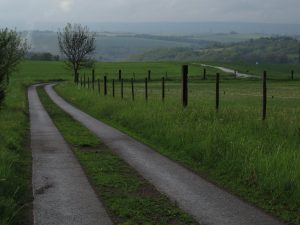
Park at roadside spaces just beyond the intersection. Continue up the paved road on foot for about 1.5k; the road has two parallel paved tracks with grass in-between. The route meanders through fields and meadow. The pavement ends at a T-intersection. Gated dirt roads go to the left and the right, following the edge of a steep ridge.

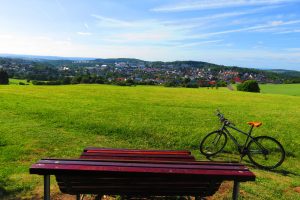
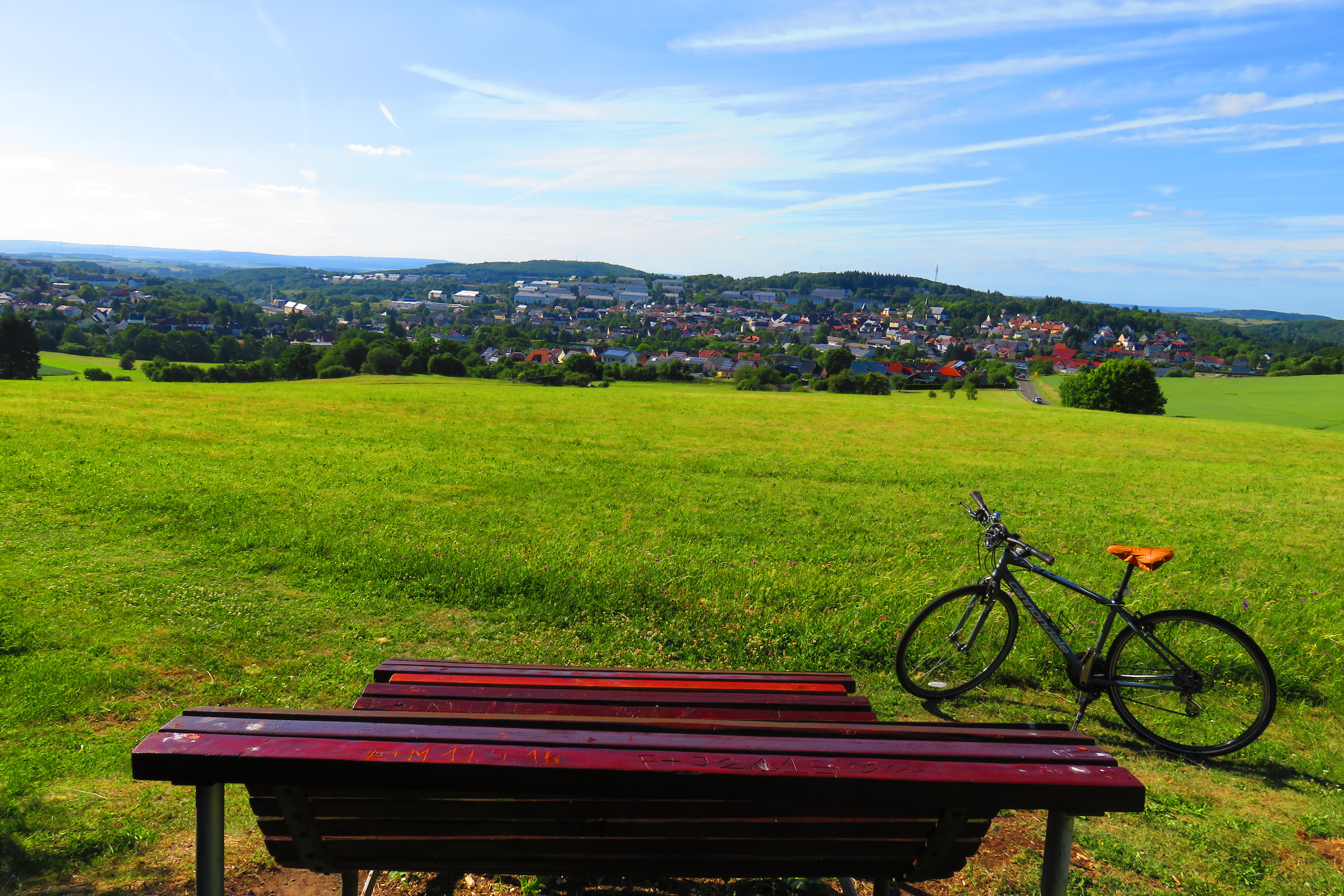
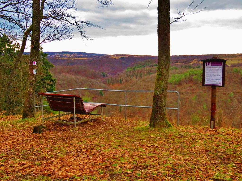
Walk down the dirt road to the right for 250m/¼ mi. until the Bärenbachpfad trail drops off the road to the left (watch for the sign). Follow the trail a short distance to a dramatic blick overlooking the Totenalb River valley. This blick features one of the Germans’ delightful reclining park benches! Retrace your steps back to the trailhead or – on a whim – explore the Bärenbachpfad– in either direction – as far as you wish.

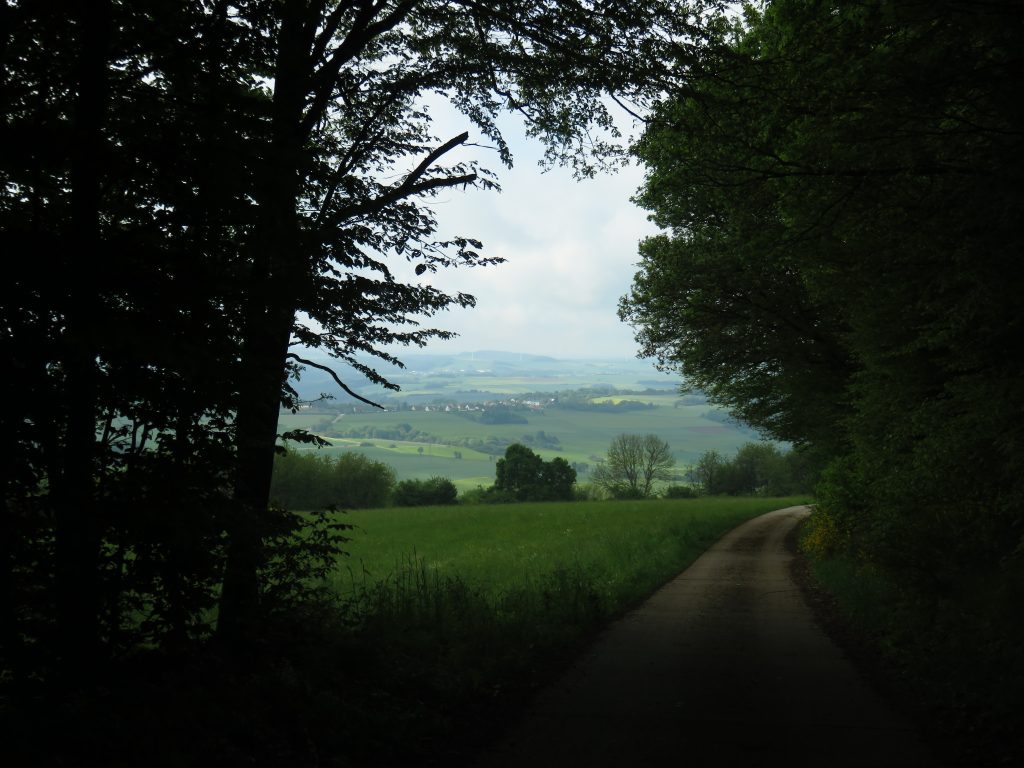
Trail 3.7. Deep Forest Interlude – A short, scenic walk from the Trail #3.6. trailhead

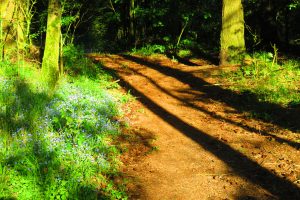
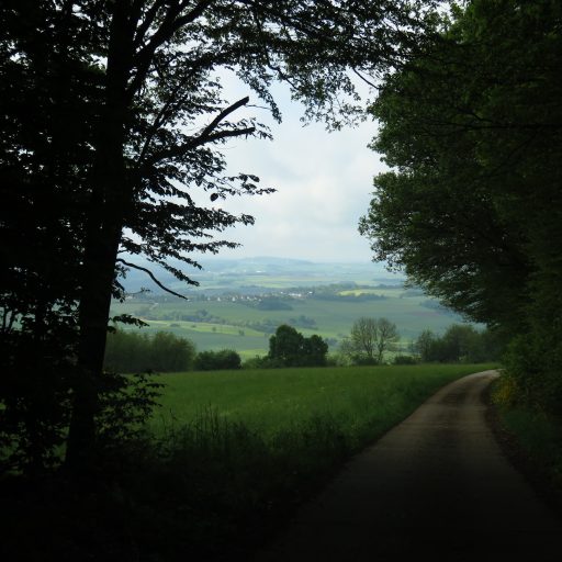
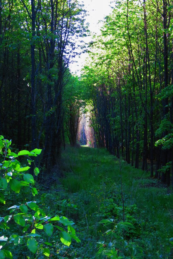
From the intersection where the hike (Trail #3.6. above) begins, walk 30m/ 30yds to a dirt road on the left; note the Bärenbachpfad signs. Follow this road uphill for about 10 minutes. The trail leaves the road to the left. Here the Bärenbachpfad enters an appealing deep, shady forest for a short distance. Continue on the trail if you like, then retrace your steps back to the trailhead.

A dense, young forest characterizes this hilltop section of deep ‘hochwald.’

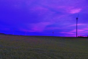
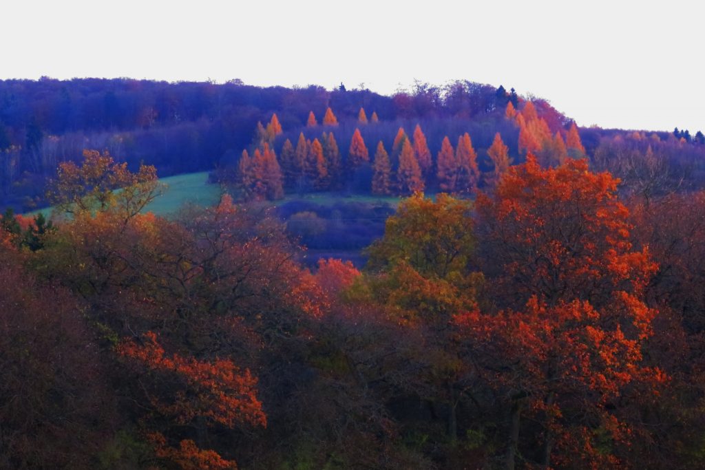
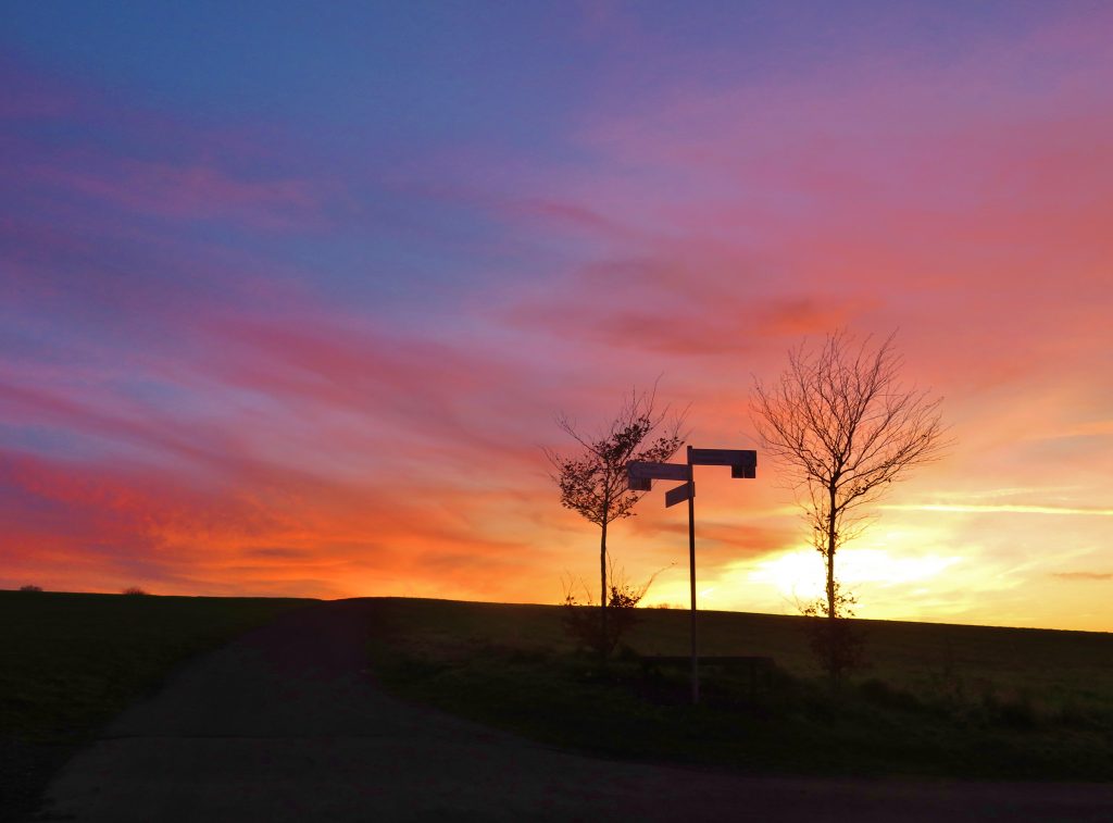
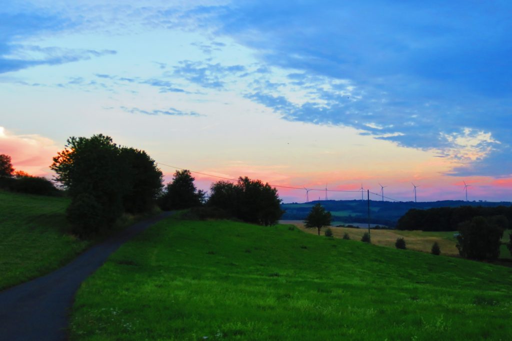
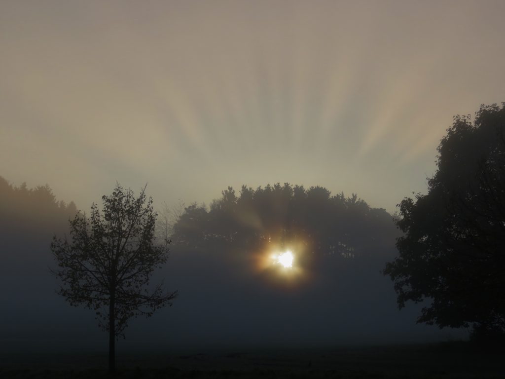
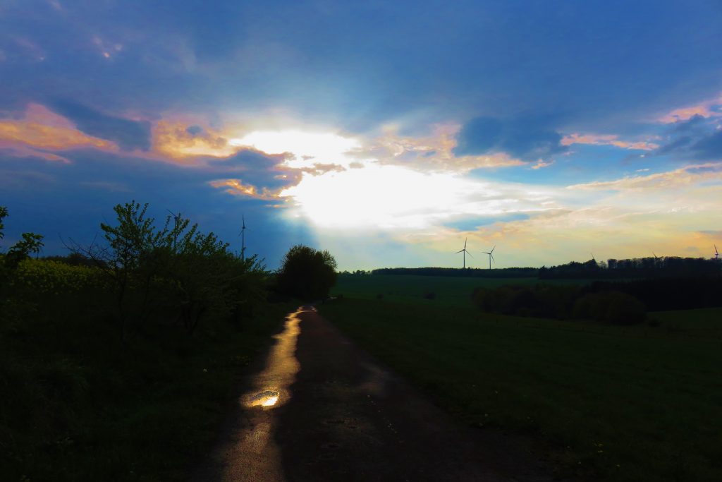
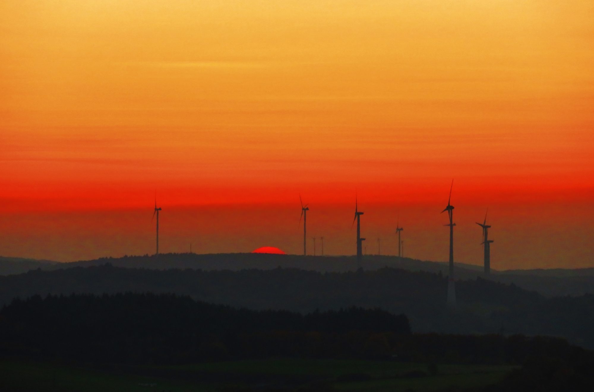
Here’s hoping you have a fine weathery walk in Gärtel ASAP! Try to time your walk to see the glorious sunset art!

And on,

Dr. Mike

Sunset looking southwest from BaumBlissBlick on the ‘stick’ of the Bärenbachpfad ‘lolipop’ trail.

The Winders of Zwillingbäume

Treeless hilltops in the bergland are often home to families and clans of Winders, a unique species which appear to be a giant, sturdy, and quickly-reproducing species of fungus.

The family of ‘Winders,’ near Zwillingbäume.

This photo captures all four members of the Zwillingbäume Winder family. The juveniles are hiding behind the trees while Mama, on the left, spins proudly on the soft crest of the hotchmoor. Notice that the youngest is closest to parent, the pubescent teen is farthest, and the middle kid – as always, in the middle. The juvenile Winder has one stripe, a second stripe appears on the yearlings; the teen sports three stripes – the ultimate in Winder flamboyance, key to the subtle mating dance and song. As in many species, upon reaching adulthood, the Winder loses its color, except in certain subspecies which maintain a stripe around the base. Winders communicate with the sound of the wind, and their flashing red lights; the weather is their favorite topic of conversation.


Trail #2: The Tranquil Realm of Zwillingbäume

“But why think about that when all the golden lands ahead of you and all kinds of unforeseen events wait lurking to surprise you and make you glad you’re alive to see?” ~ Jack Kerouac, On the Road

A view over Mettweiler and the valley of the Hirschbach near Zwillingbäume and Eschelbacherhof.

Note: To see the a gallery of photos in this post in a full-screen size slideshow, follow this link: https://photos.app.goo.gl/xBu4O0uM1NyQF3Pm1

Zwillingbäume is a wondrous realm – and where our bicycling tours doth begin.

A few kilometers south of Baumholder – hidden in plain sight between two busy highways to the autobahn – the seven-house farming village of Eschelbacherhof sits at the center of an idyllic realm for bicycling and walking.

Just up the hill from Eschelbacherhof is ‘Zwillingbäume,’ a crossing of the three designated bicycling trails near Baumholder – and a delightful 360-degree view of the bergland! Zwillingbäume is near the top of a broad, grass-covered hill – a hochmoor. Green and serene landscape is in view at all compass points –hayfields and crop-fields stretch outward over the grassy rolling hills, past the silently spinning wind turbines and downslope to the steep, dark forests.

Zwillingbäume is an intersection of three radwege (bike trails) near the hamlet of Eschelbacherhof.

Zwillingbäume means ‘twin trees.’  A wooden park bench and two wrist-sized trees mark the spot. (There is parking here for one or two cars.) On this broad moor, the twin trees are the only trees for a kilometer in any direction. Hay meadows of cropped grasses – with scattered patches of woods – cover the nearby hills.

Looking toward the top of the hill ‘Huf’ from near Zwillingbäume .

Starting from Zwillingbäume, walk southeast for ten minutes up a grass expanse to the summit of a hotchmoor hill called ‘Huf,’ a perfect spot to watch the sunset over the Nahe River Valley. The ridgeline of the ancient forest of the Hunsrűck Hochwald forms the northwestern horizon. As the sun nears the horizon on partly- cloudy afternoons, clouds beings and sunlight present a polychromatic sculpture and lightwave show! The four windmills that I call ‘The Family’ spin benevolently above.

‘The Family’ on the hilltop called ‘Huf,’ near Zwillingbäume.

Just over the hilltop to the west is the hamlet of Eschelbacherhof, a working farm village with about 7 houses, founded in 1769.

Eschelbacherhof, a farming hamlet in the Nordpfalzer Bergland, Rheinland-Pfalz, Germany.

Zwillingbäume sits at the confluence of three radwege – designated bicycling trails: The 72k Rheinland-Pfalz Radweg, the 28k Bergen-Radweg and the 30k Seeradweg. (See upcoming posts on the Rheinland-Pfalz Radweg, the Bergen-Radweg and the Seeradweg designated rides.) From Zwillingbäume , great biking/walking roads, paved and dirt, head out in all directions.

This passel of trails will be described below, in the Trail Description.

The bicycling signage at Zwillingbaum in sunset glow. The yellow bicycle wheel is the emblem for the Rheinland-Pfalz Radweg. The maroon castle represents the Bergen-Radweg. The Seeradweg also crosses this intersection enroute to the Bostalsee.

Rides in the bergland usually begin in a village, then head up through the forest, over the moorlands, and down to the next village. The standardized bicycling signs indicate the distance to and direction of the next village. Most rides are easy to navigate – simply follow the signs from village to village.

Autumn in the bergland, near Mettweiler.

Now get out there on the hochmoor! You’ll see hawks, hares, deer and foxes – and cows, sheep, goats and horses. This green world – with clouds above – will offer calm. The light of evening will offer hope. You will soon be smiling.

The middle of nowhere turns out to be the center of here and now.

The spirit is strong, and the flesh is Zwilling

Zwillingbäume autumn sunset

ROUTE SPECS        

Trail name: Trail #2: Zwillingbäume routes  2.1 – 2.7

Location: 3k south of Baumholder, Rheinland-Pfalz, Germany

Length: unlimited length options. The area features 3 designated bicycling trails heading off in six directions, plus dozens of paved and gravel country roads begging for exploration.

Challenges: Climbing up-hills / Rewards: Cruisin’ coasting down-hills!

Route-finding: Easy

Highlights: historic farming villages, wohnstallhäusen – house/barns, die Blicke – scenic views

Click here to open the full-size printable PDF map for TRAIL#2.1.-2.7.:

Zwillingbaume.map.v3

Map Legend for Zwillingbäume:

Click here to open the full-size printable PDF of the Zwillingäume MAP LEGEND:

Zw.map.legend.v2

TRAILS DESCRIPTIONS

Suggestion: Open or print the map before reading the trail descriptions.    

See circled numbers on the map which correspond to the descriptions of the seven suggested trails.

Trail #2.1. Baumholder to Eschelbacherhof & Zwillingbäume

To find Zwillingbäume, start in Baumholder at the small traffic circle near the Bad/Lake Park on the Ringstraße, near the Netto grocery. From the traffic circle, head in the direction opposite the bad/lake. Follow the green ‘bike and arrow’ signs gradually uphill – through 1k of Germany-style suburbs to the edge of town.

As is typical of German villages, the town ends suddenly, and the beautiful pastoral countryside welcomes us. My suggestion is to drive to the edge of town, park and ride or walk the 2k to Eschelbacherhof, Zwillingbäume – and beyond!

A misty morning on the road from Baumholder to Eschelbacherhof.

The one-lane paved road curves through forest with glimpses of meadows, drops into the creekbed of Eschelbach and then climbs toward the hamlet of Eschelbacherhof.

The road reaches to a ‘T’ intersection. To the right, the Rheinland-Pfalz Radweg and the Bergen-Radweg head west toward the Nahe River (see Ride 2.2., below). To the left is the hamlet of Eschelbacherhof. ‘Hof’ means ‘farmstead’ and is usually a group of houses and outbuildings forming one or several farms.

Amazingly, this tiny hamlet features a ‘landschaftsgaushaus,’ a country inn – restaurant and tavern, Landgasthof Zur Scheune. (A great stop for beer or eis while riding. Just saying.) The road through the cluster of farmhouses is so narrow and intimate – one is literally in the hof (barnyard)!

www.landgasthof-zur-scheune-eschelbacherhof.de

Sunset view over Eschelbacherhof from near Zwillingbäume .
Eschelbacherhof is a working farmstead.

At the edge of the village, the road/trail takes a sharp turn and climbs to the hilltop above the town. Follow the road around the sharp left turn near the gaushaus and climb up – among the barns and machinery of a working farm – to the 4-way intersection of country roads I call Zwillingbäume . Form here, head out in any direction and explore the fine rides/walks outlined below – or discover your own!

Trail #2.2. Zink    

This out-and-back route begins at Zwillingbäume and heads west along the overlapping Rheinland-Pfalz Radweg and the Bergen-Radweg. (Both will be featured in future blog posts.) The routes are well signed and continue any distance desired. The trail heads west-northwest through alternating forest and moor. The trail crosses the main highway from Baumholder to Freisen, then continues into an area I call ‘Zink,’ across the  farmstead Zinkweilerhof.

Trail #2.2. Misty morning view on the trail to Zinkweilerhof.

The well-signed bicycle trail continues mostly downhill through Zinkweilerhof farm fields and meadows, eventually reaching the town of Heimbach on the Heimbach River, a tributary of the nearby Nahe River. (Note: don’t miss the great bäckerei in Heimbach). From Heimbach, the trail climbs a long, steep climb up to – then over – the moorlands, eventually descending to the Nahe River farther downsteam. (This route will be covered in detail in a later post on the Bergen-Radweg.)

Trail #2.2: near Zinkweilerhof

Trail #2.3. Eschelbacherhof to Mettweiler Forest Road Loop – West             

One of my favorites, this route traverses a deep forest on an overgrown dirt and grass road between Eschelbacherhof and Mettweiler.

The mostly-downhill road from Zwillingbaum to Mettweiler.
Trail #2.3. Forest on the road to Mettweiler.

This loop trail begins in Eschelbacherhof. At the west edge of town an unpaved road heads south into the forest. The road curves along the traverse of a ridge  and drops down into the valley of the Hirschbach and the village of Mettweiler.

Riders near Eschelbacherhof.

Soon after entering Mettweiler, watch for a road to the left which heads back up the hill to Eschelbacherhof – your starting point, on a paved road.

The road back uphill from Mettweiler to Escherbacherhof. The sign shows a red line through the village one is leaving and an arrow pointing to the next village. This eases navigation challenges and increases relaxation.

Trail #2.4. Zwillingbäume to Mettweiler Forest Road Loop – East     

This loop ride begins at Zwillingbäume and heads southeast on the gravel road. This section of road is one of the flattest rides in the whole area! After about .5k, the road enters the forest. This section is part of the Rheinland-Pfalz Radweg and the Bergen-Radweg (which eventually leads to Berg Lichtenberg in Kusel.)

Trail #2.4: Looking back toward Zwillingbäume , heading toward the folly tower.

After another kilometer, along the side of the forest road sits an surprising sight – A 12-meter tall miniature castle tower! The tower features a sloping roof and Rapunzel-type window. The doorway is open. Inside, looking up, we see two concrete floors creating two small stacked rooms. The half-circle cutouts in the concrete floors suggest it was designed for a missing spiral staircase. I was baffled by this structure until I met a group of women hikers nearby. They explained that the tower was originally a relay station for rural electrification, now abandoned. A local man was working to convert it into a castle tower folly for the enjoyment of volksmarchers passing by. Sadly, the man died before completing his quixotic project.

Trail #2.4. The folly castle tower on the Rheinland-Pfalz Radweg and Bergen-Radweg between Eschelbacherhof and Breitsesterhof, near Baumholder. A ‘folly’ is typically built in a garden for decoration to bring pleasure to viewers.
Trail #2.4. Looking straight up inside the folly tower. Two concrete floors are in place and are set up for a spiral staircase. The rectangular opening is in the upper floor with the wood ceiling visible above.
Trail #2.4. Compare the ‘Rapunzel Tower’ to a typical obsolete electrical transformer tower seen in the German countryside.

Continue straight – east – on the road. Watch for the next forest road to the right and take it. The road eventually loops around and down to Mettweiler. In Mettweiler, follow the paved road back uphill toward Eschelbacherhof. Ascending the road, watch for where the main paved road makes a big switchback to the left. Instead of cutting left and continuing uphill at the hairpin turn, take the road to the right, which is flat. There is a sign nearby which announces the road as ‘Welsch Allee.’ This road leads back to Rapunzel’s Tower. At the tower, turn left and ride the flats back to Zwillingbäume.

Bier ad on barn in Mettweiler.

Trail #2.5. Mettweiler to Fohren-Linden and Beyond      

This out-and-back route drops down to the creekside village of Mettweiler, then continues to the southwest along the Seeradweg. The ride begins at Zwillingbäume; head south uphill 100m to the high point of the road, then enjoy a long, pleasant coasting cruise down into the lush valley and the village of Mettweiler.

Trail #2.5. Looking north from the high point on the road to Mettweiler. The signs near the cows mark the Zwillingbäume intersection. A section of the road to Baumholder is visible in the mid-distance.

From Mettweiler, the trail climbs to the hochmoor and drops again, through the forest into the village of Fohren-Linden and continues for another 25k – up, then down to village, up and over, then down to village – all the way to the Bostalsee (a reservoir of the Nahe River which will be detailed in future posts on the Nahe River Radweg).

Trail #2.5. The flowering trees and shrubs of Springtime, near Fohren-Linden

Trail #2.6. Bruderbach Trail                       

This trail is ideal for a short, shady creekside walk.

Begin on the Baumholder Ringstraße at the traffic circle near the Bad/Lake Park and Netto Grocery. Take the road opposite the park and grocery and follow the green bike & arrow signs along a residential street. After about 500 meters, watch on the left for a narrow, hard-to-see road between two houses; it is not signed and looks too narrow to be a road. Nonetheless, it is the road to Bruderbach, one of the creeks feeding the Baumholder bad/lake. Park on the street and follow the road between the houses which soon enters the serene woods and follows the Bruderbach upstream along a tree-lined road. The road continues along the creek before heading up into the hills; the first kilometer is the most scenic. This is a popular walking trail in the afternoons.

Trail #2.7. Berschweiler to Eckersweiler on the Old Road

This out-and-back ride begins on the bike route just east of Berschweiler. From the center of Berschweiler, follow the bike signs pointing out the bike route to Mettweiler. About .5k up the bicycle trail/road from Berschweiler toward  Mettweiler, take a road heading south which immediately crosses a bridge over a noisy creek, past an old barn, then begins a climb to the open hilltop meadows and drops down into Eckersweiler, where a gasthaus awaits!

Trial 2.7. The final leg of the ride – pleasant view and pleasant coast into Eckersweiler.
The Eckersweiler kirche spire.

 Hof & Hochmoor Etiquette

You may feel like you are out here all alone, but these are real roads, used mainly by locals. Please be respectful! This is not a museum. I admit to being out riding, stopping to take a photo and getting all absorbed in shooting the photo, only to realize a quiet car has approached and its occupants are politely waiting for this tourist to get out of the way, so they may go about their day. When parking, be sure your vehicle is completely off the road, since farmers must drive giant farm machinery on these country roads.

Contrasting view through the verdant forest of the hochwald (hill country forest).

Photo-tip

If you are a landscape photographer, stay alert to the changing sunset and sunrise times during the year. Get out for a ride/walk and photo-shoot during the falling dark of the ‘Golden Hour’ – from just before sunset to dark – as often as possible. Dinner can wait! Seek a location with a view of the sky and an interesting scene in the foreground.

A unique sunset – with jet trails – over the bergland.

First light to sunrise is the other golden hour. Get to the trailhead before dawn, ready to capture the first light – breakfast can wait! The morning mists, the evening cloud formations, the sunset hues are epic. The windmills are a fine photographic complement to a dramatic sunset – or sunrise – skies above the verdant bergland.

Sunrise rays filtered through trees and mist, near Breitsesterhof.

Note About Pronunciation

Since some German and English words are similar, it is easy to forget that pronunciation is quite different in German and English. For example, ‘w’ in German is pronounced as ‘f’. The ‘zw’ in Zwillingbäume features the odd-to-our-ears ‘z’ followed by an ‘f’ sound. So, Zwillingbäume= “SSS-feeling-bom-eh.”

Zwillingbäume sunset.

Please comment if you have a chance to walk or ride in the Eschelbacherhof area! Direct comments / suggestions / questions / corrections to this post – or to drmikebowers.guide@gmail.com

And On!

~ DrMike

Self portrait with camera.

All photos by Dr. Mike Bowers

© Ideaphoria, LLC

Contact: drmikebowers.guide@gmail.com


Hopp. Lake Trail: A Kid-friendly Family & Friends Day-hike Near Baumholder

Hopp. Lake Trail: A Kid-Friendly Family & Friends Day-hike Near Baumholder


Soon after autumn sunrise

~ A 20-minute drive from Baumholder ~

~ Note: In this guide, ‘Family & Friends’ trails are ideal for families and groups of friends. These trails are usually short, flat and feature points-of-interest along the trail.

  • WHAT: A scenic, short family-friendly trail which is easy to get to from Baumholder. A great way to begin – or continue – exploring nearby trails in the German countryside. Getting out into nature deepens our experience of this fascinating, historic and beautiful place.
  • WHO: Anyone who can walk 1 mile on a level trail and enjoy the beautiful German countryside.
  • HIGHLIGHTS: Lake views, stone railroad bridge and trains, misty forest, safe-but-fun log bridge, and a view across a meadow to a church-spire & village
  • SAFETY ISSUES: The well-defined grass and dirt trail parallels the edge of the shallow lake at a safe distance.
  • HEALTHY LIFESTYLE ISSUES: Turn off your phone – and relish nature, the weather, the clouds, the reflections on the water – and revel in the good company of your adventurous friend and family.
  • LENGTH: 1 mile/1.5 km roundtrip, out & back
  • DISTANCE TO TRAILHEAD: 10 km, 20-minute drive from Baumholder. NOTE MILEAGE: Directions and mileage starts at the intersection at the main gate to USAG Baumholder – Smith Barracks. Very simple navigation and driving on low-traffic, level-but-curvy 2-lane paved roads.

Directions to the Trailhead

From the intersection at the front gate of Smith Barracks (main base), take the road between Smith Barracks and Clinic Kaserne in the direction of Idar-Oberstein. Turn RIGHT at the stoplight, then continue on that highway to the trailhead. (Instead of turning right to Idar-Oberstein and downstream Nahe River Valley, go straight toward Heimbach, upstream). Continue on this curvy riverside highway through the town of Heimbach (perhaps a quick stop at the good bakerei/bakery near the pedestrian crossing?). After a short stretch of road, a Peugeot auto dealer appears on the left. Around the next curve, on the left is a big official-looking building with an impressive row of translucent windows. This is the machine house for the Hoppstadt Dammen, a small dam and waterworks on the Nahe River. Drive just 30m/100 yards past this building and look for a gravel parking lot on the left side of the highway. Carefully cross traffic and park there. Walking and running only beyond the gate.

Trail Guide

  • The trail begins at the gate and soon reaches the edge of small pine-framed lake, a see in German. This lake is a reservoir of the Nahe River. Following this trail away from the parking lot is heading upstream.
  • Walking along the lake, look left toward the near-end of the lake. The buildings are the waterworks at the dam.
A early morning view across the lake to the old waterworks buildings and the dam.
  • As the trail continues, a dignified two-arch stone railroad bridge comes into view at the narrowing top of the lake; our trail passes underneath. Watch for the sleek and silent trains passing every 10 minutes or so. (See family game idea, below).
The double arch railroad bridge over the Nahe River. Trains pass by about every 10 minutes or so.
  • Walk below the bridge on the narrow path between a column of the bridge and the river.
  • The trail continues for a while through a forest of young trees, then crosses a small tributary creek on a fun-but-safe log bridge with a log handrail. Kids will love it!
A fun log bridge over a tributary creek near the end of the walk. When the water is just over the top of the log, this is a safe adventure for children. The bridge has a handrail.
  • Suddenly, the trees end, and the hiker is rewarded with a view over a wide meadow, church spire and village in the distance (on your toes, photogs!). Turn around here; heading back proffers a new perspective on the now-familiar scene…a dollop of serene nature and a train bridge to remind us that we are in Germany!
Dew-jeweled cobwebs, one reward of getting up early for a sunrise walk.

Photo Tips

  • Visit at dawn or sunset to capture dramatic light and reflections.
  • Can you find the spots on the trail where the stone arches of the bridge reflect on the water to form a perfect stone circle?
  • Water, bridge, mist, forest, church-spire across meadow – you will get some great shots!

Family Game

Work together as a team to get a photo or video of a train crossing the bridge and lake. Trains pass about every fifteen minutes – then they pass fast! Everyone can help watch and listen for and announce the train. “Be on your toes with your eyes peeled,” as my dad said it. The photographer must be ready for action! How about a portrait with the models appearing to hold the train on their up-stretched hands?

About the Train

This is the Nahe River Line. Trains heading upstream (left to right) follow the curving Nahe River for a while, then head west to Saarbrucken; from Saarbrucken a TRV bullet train zips to Paris. Downstream (right to left), the track follows the Nahe River Valley to Idar-Oberstein and on through the Nahe wein region, where it feeds the mighty Rhein River at Bingen.

~ If you visit this trail, please tell us about your adventures!                        

   Corrections appreciated. Veilen Dank!           

And on…   ~ DrMike


One dozen FAMILY & FRIENDS DAY-TRIPS near Baumholder, Germany

 One Dozen FAMILY & GROUP DAYTRIPS from Baumholder

  •  Put on your boots, grab your camera, pack a day-pack (don’t forget your raincoat and/or umbrella) – then head out and explore the lush green and the ancient farming villages of the Rheinland-Pfalz – Germany countryside!
  • A GPS makes these places easy to find. Using an analog/paper map, follow the signs from village-to-village on your route. The main roads to the villages and bigger towns are well-signed and give the distance to the next town in km; don’t count on useful signage (in English) on any back-roads.
Rolling hills near Potzberg.

One Dozen FAMILY & GROUP DAYTRIPS from Baumholder

  1. NATURWILDPARK FREISEN, in Freisen, 15k from Baumholder
  2. WILDPARK POTZBERG, near Föckelberg, a one-hour drive
  3. ZWEIBRUCKEN WORLD-OF-FUN, in Zweibrucken, near Landsduhl
  4. TOPPLESHAUS, Topple Upside-down House
  5. “GO! INDOOR-KART” GO-KARTS CENTER in Kaiserslautern
  6. BLUMEN” CUT-YOUR-OWN FLOWERS in Kusel and Hoppstadt-Weiersbach
  7. BOSTAL SEE, nearby large lake and dam walk – lots to do!
  8. BURG LICHTENBERG, nearby castle ruins
  9. GARTENSCHAU DINOLAND PARK, garden, educational exhibits in Kaiserslautern
  10. BAD SOBERNHEIM BAREFOOT PATH (barfupfad) & GEOLOGICAL TRAIL
  11. WEISELBERGBAD FREISEN-OBERKIRCHEN, Indoor swimming pool in Freisen, 15k from Baumholder
  12. Hopp. Lake Walk – next week’s blog topic

See below for details, address and contact information, below. Please comment if you visit any of these activities!

 1. NATURWILDPARK FREISEN, in Freisen, 15k from Baumholder

Activities: Outdoor animal exhibits – 30+ species, adventure playground, snacks, Eagle demonstrations

Ages: All!

Website:  www.naturwildpark-freisen.de

Hours: 1 MAR-14 NOV: 1000 – 1800; 15 NOV – 28 FEB: 1000-1600; Raptor shows. Wed. at 1530
Phone:  0 685 599 6463

Address: Hermbachhof 1, Freisen 66629

A corner of Potzberg Castle, now a restaurant near the nature park/outdoors zoo and the hiking trails.

2. WILDPARK POTZBERG, near Föckelberg, a one-hour drive

Activities: Wildpark, petting zoo & playground, nature reserve specializing in birds of prey, highly-rated falconry shows

Ages: All!

Prices: 8€ for adults and 5,50€ for children over age 4

Website: wildpark@potzberg.de

Hours: 1000-1800, Birds of Prey demonstration at 1500 (weather permitting)

Phone: 0 6385 6249

Address: Am Potzberg 1, 66887 Föckelberg


3. ZWEIBRUCKEN WORLD-OF-FUN, in Zweibrucken, near Landsduhl

Activities: Family entertainment complex with a kids’ play zone, ice rink, bowling alley, mini golf & dining

Ages: Toddler to adult

Prices: Free entrance, pay by activity (see website for detailed price list)

Website: http://www.wof-zw.de/

Hours: 1400-0100 (hours vary depending on season and day of week, see website for detail list of hours)
Phone:  06332 4817970

Address: Europa Allee 11, 66482 Zweibrücken


 4. TOPPLESHAUS, Topple Upside-down House

Activities: Fun-to-explore upside-down fully-furnished house and a car in the garage…

Ages: All!

Prices: Entrance fee – 4,50€

Website: www.toppelshaus.de

Hours: Open daily 9am to 7pm

Address: Almosenberg 6, 97877 Wertheim


 5. “GO! INDOOR-KART” GO-KARTS CENTER in Kaiserslautern

Activities: Go-Kart rides, snacks, video games, birthday parties

Ages: 7 and up. 7-10 years in Kid Karts; 11-13 years in Fun-Karts; 16+ years in Double-Seater

Prices: Kid-Kart & Fun-Kart: 10m/12€, 30m/32€; double-seater: 10m/14€m 30m/38€

Website: www.go-indoorkart.de

Hours: M-Th 1600-2300; F 1500-0100; Sa 1300-2400; Su/German holidays 1100-1300

Phone: 0 630 130 0250

Address: Carl-Denk-Strasse 2, Kaiserslautern-Erfenbach 67659


6. “BLUMEN” CUT-YOUR-OWN FLOWERS in Kusel and Hoppstadt-Weiersbach

Activities: Fields of blooming flowers, cut yourself and pay for what you cut

Ages: All!

Hours: Always open, seasonal availability
Address:
Two nearby locations: The nearest to Baumholder is on the highway between Heimback and Hoppstadten-Weiersbach (on the highway that goes to the Bostalsee); the other nearby ‘Blumen’ is along the route to Autobahn 62 from Baumholder to the Kusel autobahn entrance. After making the right turn in Kusel, watch on the right for the flowers; it is about 2k before the Autobahn entrance ramp.

The Bostalsee, a reservoir of the Nahe River.

7. BOSTAL SEE, nearby large lake and dam walk – lots to do!

Activities: Paved trail around the lake, playgrounds, bike rental (self-powered go-carts for teens!), boat rental, lake   swimming area, restaurants/beirgarten, camping, music pavilion, mini-golf

Ages: All!

Website: www.bostalsee.de

Hours: trail around lake always open; times vary for services (see website)
Phone: 0 68 529 000

Address: Am Seehafen 1, 66625 Nohfelden-Bosen. Follow L-135 toward Nohfelden, or set GPS for Neunkirchen, then follow the signs to ‘Bostalsee.” About a 30-minute curvy-but-flat drive from Baumholder

Sunset view of Burg Lichtenberg, near Kusel, 20 minutes from Baumholder.


8. BURG LICHTENBERG, nearby castle ruins

Activities: Castle ruins to explore, reconstructed tower to climb, well-rated restaurant, nice playground

Ages: All!

Prices: Free to explore ruins, no charge to climb tower, moderately-priced restaurant

Website: https://en.wikipedia.org/wiki/Lichtenberg_Castle_(Palatinate)

Hours: Castle ruins open during daylight hours
Address: Set the GPS for Tallichtenberg, then follow signs to Burg Lichtenberg, ample free parking, about 30 minutes from Baumholder


9. GARTENSCHAU DINOLAND PARK, garden, educational exhibits in Kaiserslautern

Activities: Life-size dinosaur figures, Lego play area, waterplay area, gardens, restaurant

Ages: All!

Prices: Under age 5 – free; over age 5 – 5€

Website:  www.gartenschau-kl.de

Hours: Monday to Saturday, 0900-1900
Phone:  0 631 71007-00

Address:  Gartenschau/ Turnerstraße 2/ 67659 Kaiserslautern


10. BAD SOBERNHEIM BAREFOOT PATH (barfupfad) & GEOLOGICAL TRAIL

Activities: “The Barefoot Path in Bad Sobernheim is the first trail of its kind in Germany offering 3500m of unforgettable adventure for explores both young and young-at-heart.” Features include a clay pool, an agility course, various surfaces for barefoot sensations, a 40m suspension bridge, geology exhibits and a creek crossing on a small boat.

Website: www.bad-sobernheim.de

Hours: Open from 1 May to 3 October, daily from 0900 to 2000

Phone: 0 160 95 46 55 05

Address: Bahnhofstraße 4, Bad Sobernheim


11. WEISELBERGBAD FREISEN-OBERKIRCHEN, Indoor swimming pool in Freisen, 15k from Baumholder

Activities: Indoor swimming pool with adult, kid, and toddler areas

Ages: All!

Prices: 4.50€ Adult, 2.50€ Kinder (children), Under 6 years free; Annual membership: 240.00€ adult 160.00€

Website: http://www.freisen.de/weiselbergbad/

Hours: Go to website, click on ‘Öffnungszeiten’ (open hours) to see the complicated hours. ‘Familienbad’ means ‘mixed bathing’ – free swim

Phone: 068 556 880

Address: Zum Schwimmbad 7, 66629 Freisen-Oberkirchen

Hopp. Lake soon after autumn sunrise.

12. Hopp. Lake Walk – next week’s blog topic. See you at acrosstherollinghills.net!

*Thank you to the spouses & soldiers of the Baumholder Military Community who shared their discoveries & helped compile this list. Don’t miss your chance to explore the beautiful countryside, towns, villages, farms & natural areas around Baumholder! Deepen your experience – and memories – of your time in Germany!   ~DrMike

Tracing Trails

Tracing Trails

One-lane paved roads unfurl across open meadows and over the light horizon of the rounded hill’s arc, up and up – until – down and down. Bursting out of deep dark of forest into the brilliant cacophony of light. Unpaved side-roads beckon. The trails divide and join, crisscrossing the gentle, rounded core of the continent. We feel the gradual change of nature, the evolving change of weather and the instantaneous change in the the perpetual dance of sunlight in the skies and across the land.

The work of the climb, the joy of the rolling – the rolling wheels guided by the rolling hills.

This gallery captures the joy of seeing the road stretching ahead, the quick progression, the raw gratitude for sights seen, sights ahead around the next turning of the trail: meadow, forest, creek, village, wild-flowered glen.

How is it that these elegant, endless variations on the theme never make an aesthetic mistake?

Rapssaat flowers with the Rauschberg Kirsche on the horizon.
Out of the darkness, into the misty opalescent distance.
Near Tannenhof Junction. Two roads appear to be going the same direction, but, upon exploration, go to two entirely different places. The green bike & arrow sign is the designation for the Seeradweg, a 30k designated bicycling route from Baumholder to the Bostalsee. The trail to the left, the Ostertal, soon crosses the A62 autobahn and heads into Saarland, a small German state on the French border.
Up and over!

And on…

Trail #1. BaumBlickBliss Radweg ~ Baumholder, Rheinland-Pfalz, Germany

Trail # 1:

The Baum*Blick*Bliss Radweg

          Radweg: designated bicycle trail – runners & walkers welcome!

PLEASURES OF THE HOME LOOP

Don’t you have a basic loop for biking/walking/running starting from your house? Bikers/walkers/runners often have a regular route -or several – for those routine work-days evenings and at-home weekends.

Our home routes become a meditation in repetition and we know each time ’round the loop is a unique and varying experience. The physical landscape of our routine local route may not change much, but the cycles of seasons, daylight and dark, weather & temperature – change with each outing, change without cease. These variables add variety, keep it interesting. First the home route becomes a habit and, over the years, a beloved ritual.

We find comfort and rejuvenation in this balance of sameness / change. Another variables: our state of mind, our mood, our body. We stomp during angry walks; then, on that delicious late-spring evening – you know the one –  we walk with joy. The comfort of habit and repetition, the change, the sameness, becomes a beloved, meaningful facet of a life well-lived.

Evening shadows on single-track

PIONEERING THE BAUM*BLICK*BLISS STAR ROUTE

During the year I lived in Baumholder, I gradually pieced together a good loop starting at my place and looping out and back in an hour or a bit longer. The route traverses the hills around Baumholder, which is situated near some of the highest hills and ridges in the Nordpfalz Bergland, literally the “North Palatinate Upland Forest” Let’s call it the Pfalz Hill Country. (The German word for Palatinate is Pfalz. Pfalz is pronounced ‘fowls.’)

With each ride around my home loop, my enjoyment grew, the quiet surroundings relaxed my mind, worked my body, and recharged my emotional batteries. Starting in fallow winter, I watched the spring burst forth with exuberant wildflowers and bright yellow fields of ‘raapstaat,’ summer’s fertility, and autumn’s leaves painting a polychromatic paean to change

I call this trail Baum*Blick*Bliss. Climbs are rewarded with blicks – viewpoints over the hills and valleys. The variety and landscape of this ride will offer up glimpses or gulps of happy moments and bits of bliss – ergo: Baum*Blick*Bliss. The hills aren’t long, but this is a good workout; a hearty mix of paved roads, gravel roads – and, just for giggles, some smile-enducing single track and downhill grass-trail glory.

The route has ample surprises – and a money-shot blick/view looking west and southwest out, above Baumholder town and the distant Nahe River Valley. The blick, called Engelmichel, is equipped with a comfortable lounge-chair-for-two park bench – and a daily sunset cloudance over the horizon – the high, dark ridge of the ancient forest, the Hunsrűck Hochwald.

Engelmichel Blick

TRAIL NOTES

  • Finding the Start of this trail is not easy. It begins on a nondescript intersection on the east edge of Baumholder’s Ringstraße, ring road. Print off and consult the map, then, starting from the intersection with the ‘Kik’ store, follow the Ringstraße (Ring Road) uphill toward the top of town (away from the grocery stores Netto and Edeka). Go about 500m/1/3 mile uphill (walk or ride the good bike paths along the Ringstraße). Look for a parking lot full of buses on the right side.

    This nondescript intersection is the START of the route. A modest portal – treasures inside!
  • Facing the sign for this business, “Auto Westrich,” the Start is at the beginning of the paved road to the left of the sign and fence. The first section of trail follows another small paved road which drops downhill on the left.
  • The BaumBlickBliss Radweg is a ‘star route,’ meaning the trail goes out into the country, then backtracks, then heads back out on another road, then back – and so on. This makes it easy to adjust your route due to conditions and desired distance/time.
  • About half of this trail is follows the Barenbachpfad, a 14km/8-mile designated walking/running/biking loop trail which begins and ends at the Baumholder Lake Park parking lot. (The Barenbachpfad hike will be covered in an upcoming post.)
The sign for the “Barenbachpfad,” the designated hiking trail which overlaps with almost half of the BaumBlickBliss route.

To park near the center of the route: From Baumholder zentrum (downtown), drive to the intersection with the ‘Kik’ store, drive uphill on the highway (L-176) toward Kusel and Burg Lichtenberg. After about 1km/1/2 mile, take the first road to the left; it is marked ‘Gärtel’ with a big wooden arrow sign. Park in the lot near this intersection and follow sections of the trail from there. Another option is to continue 1 km along this narrow, paved road to the parking lot at the entrance to the ‘Gärtel’ nature education area. Bikes and walking only beyond the gate. This area is part of the Waldhaus Loop, point #8 on the map.

  • If you follow this trail and enjoy it, please leave a comment – happy to hear from you! ~ Dr. Mike

TRAIL DESCRIPTION

  • Time: Biking: ≈ 1 hour / Running ≈ 1:15 – 1:30 hours / Walking ≈ 2 – 3 hours
  • Distance: approximately 9 km / 6 miles
  • Surface: 2/3 paved, sections of gravel, single-track dirt and grass
  • Equipment: Mountain bike or hybrid bike, helmet, water, raingear (this is Baumholder!), camera/phone, the attached map!
  • The route can be followed in either direction; the map indicates a clockwise route.
  • The Start of the route is at the intersection of Ringstraße and Erzweilerstraße (this is Germany!) and the End is at the Baumholder Bad (lake) near the NETTO grocery and the nearby traffic circle. The Start & End are easily accessed through the Artillery Gate or the Main Gate of USAG Rheinland-Pfalz-Baumholder.
BaumBlickBliss Radweg, Baumholder, Rheinland-Pfalz, Germany. Trail map by drmikebowers.guide@gmail.com


Printable PDF of map: Baum.Blick.Bliss.map.10.17.

SEE CORRESPONDING NUMBERS ON THE MAP

  1. The Start is on a minor paved road which intersects with the eastern side of the Baumholder Ringstraße. Although there is no street-sign, the street opposite the Start is Erzweilerstraße. The Start is to the left facing the business sign announcing “Auto Westrich”; look for their big lot of tour buses.
    The nondescript START.

    2. From the Start, take the one-lane paved road which drops downhill to the left among the trees. Eventually the road levels off; go 2/3 km to the end of the pavement. The first out-and-back road leaves the town far behind. Enjoy the view, then turn around and retrace your route back to the Start intersection.

    The countryside begins at the edge of town.

    3. As you near the Start intersection, take the uphill 2-lane paved road to the left. Follow this road gradually uphill. (A short way up this road from the Start is a convenient roadside parking place.) Enjoy the nice view/blick of the valley to the left as you feel the burn during a good, steady climb. Continue gradually uphill on the paved road past a horse farm (on the left) and continue following the paved road (which becomes two parallel strips of pavement with grass in-between) to the end of the pavement.


4. The paved road ends at a T-intersection with gates to the left and right. Take a break, then turn around and retrace the road you rode in on gradually downhill to the Horse Farm (which will now be on your right, duh).

5. As you approach the Horse farm, watch for the gravel road leading uphill on your left. Take the gravel road uphill – this gravel section is one of the toughest climbs! – keeping right at the first intersection. Enjoy the view/blick as you top the hill. (Here the route begins to follow the ‘Barenbachpfad’ * signed hiking trail (for most of the remainder of the route.) Take a left when you reach the pavement. Coast downhill to a T-intersection with a paved one-lane road.

6. Turn right on the paved road and travel about 20 ft./7 m, then turn left onto the signed single-track grass-covered trail. Gain some speed and climb the eroded dirt trail up a short – but steep – section. (This is the crux of the route! Can you climb it without walking your bike?) Follow the rough dirt trail around the edge of a field until you reach a paved one-lane road.This short-but-steep section is the crux, the most section of the trail.

A portrait of beauty and serenity. These horses are usually in their field near this part of the trail.

7. Turn left onto the paved one-lane road and climb uphill for a stretch, onto a gravel road which levels out and rolls past a meadow with 2 horses usually present.

The ‘picknick’ pavilion near Waldhaus (Forest House).

8. Waldhaus Loop: Follow the road around the horse pasture to where it forms a T-intersection with a paved one-lane road. Turn left and follow the paved road downhill through the woods, over a creek, through a parking lot (for the Gärtel nature education area). Go around a closed gate keep straight on the pavement (no cars past the gate). Follow the paved road another 1.5 km to a picnic house, gazebo and grilling-pit called Waldhaus. Here the road curves left and turns into gravel. Follow this loop back to the paved road, then retrace your route back to point #9. (To shorten the route, consider skipping this loop to Waldhaus; skip to point #9.)

9. This area is a dirt parking lot (just off the highway – L-176 -which heads south from Baumholder to Kusel, note the wooden ‘Gärtel’ sign facing the highway). Cross the parking lot and follow the signed ‘Barenbachpfad’* trail into the woods parallel to and east of the highway on pleasant single-track through a Dr. Seuss forest.

Soon the trail crosses the highway (be careful crossing – high speed traffic!) and then parallels the west side of the road on fun single-track through a mossy gnome-home forest, then…

View to the west from Engelmichel Blick, a fine place to relax and watch the sunset cloudance. The trail heads downhill to the left following a zig-zag electric fence along the edge of a meadow.

10. …the trail abruptly bursts out of the forest – a great viewpoint/blick of Baumholder town is revealed. This is a great place for a break, hydration & snack; enjoy the 2-person lounge-chair park bench! The view to the west is quite pleasant at sunset.

11. From the view/blick, the trail descends the hillside meadow beside a zigzag electric fence at the edge of a broad meadow on a trail of grass. (Be sure to notice the variety of wildflowers during spring and summer.) (Very slick when wet!)

12. When the grass trail meets the pavement, turn left and follow the one-lane paved road uphill to a fork, take the gravel road to the right. Climb gradually through the woods and meadows until you reach the first dirt road on the left.

13. Turn left on the dirt road – or just before the road to cut across the grass for fun!

14. Turn left at the next partly-paved one-lane road at the corner of the cow meadow – and kick back & enjoy gravity. Feel the exhilaration of your well-earned coasting cruise to the End !

15. Roll down the road until you see the Barenbachpfad* trailhead turn left toward Baumholder town (near where you started the loop you just rode). This part of the trail passes one of the many seep springs which feed the

16. Baumholder Bad (a spring-fed lake). Lush pasturelands just beyond the edge of town – quintessentially German! Carefully cross the busy Ringstraße and End at the Baumholder Bad.

*Barenbachpfad = Baren: Bear / bach: creek / pfad: path

Introduction

Fortunate Fate

Fortunate fate brought me  to the Rheinland-Pfalz region of Germany – from my dear home in Denver, Colorado, USA -to work and live for one year. Soon after arriving in Baumholder in December, I bought muck boots at the Baumarkt hardware store then began striking out from the edge of town, stomping around the countryside.

I discovered one-lane paved country roads with few cars, lots of cows, photogenic pastoral scenes and blicks – viewpoints overlooking the forested valleys.

… Began to see the rolling hills, the diverse, well-managed forests, the treeless hilltop moors – the high meadows, fields and pastures, ancient worn-down hills.

… Began to hear the silence and to resonate to the hum of the windmills’ whirling antic blades. A landscape gentle, a subtle delight for all the senses – natural beauty gently-manicured, a working land of tiny hamlets, farms, well-conserved forests and high, open moorlands.

“I have dropped into the very place I have been seeking.”

~ Isabella Bird (the first woman to climb Pikes Peak)

The Mission of acrosstherollinghills.net

– is to guide people exploring the German countryside by bicycle, walking, driving and family/friends activities. This guide focuses on the Nahe River Valley region of Rheinland-Pfalz, in west-central Deutschland. The guide will feature bike rides in the area, but will also include walking trails, family activities and points of interest in this serene and beautiful countryside.

Beyond Germany’s “Must-Sees”

Visitors to Germany arrive with a long list of ‘must-sees,’ and leave wondrously wowed by the world-class sights, foods, beverages, historic cities and castles. These visitors do go home fat and happy. Tourists see Famous Germany, but often miss the serene beauty of the quiet back-roads and rural rhythms of life out among the villages, forests and farms.

Those of us fortunate enough to live in Germany for any amount of time revel in the abundance of non-famous – but fascinating places we discover. Known mainly to locals, they are rarely visited by non-German visitors. No souvenir shops out here, no painstakingly reconstructed historical zones.

cropped-IMG_9268.jpg

Discovering the Nordpfalzer Bergland

This land is as it has been for long centuries – the green and gentle hills, the mossy forests, the hay-fields, the house-barns, the creeks and seeps – here is the land – manicured after hundreds of years of kind human care and wise use. Life here reflects and honors thousands of years of agricultural life in rural Europa.

Rheinland-Pfalz is one of 16 states in in west-central Deutschland, near the French border with Alsace. In the eastern range of the state, the mighty Rhein River flows through the largest viticulture region in Germany. Here in the western reaches, called the Nordpfälzer Berglandthe North Palatinate Forest – rolling hills, deep river valleys, forests, pastures & cropland. Along the many creeks are tidy farming villages full of ancient wohnstallhaus – house-barns, home and barn under one roof.

House-barns or ‘wohnstallhaus’, are common in the farming villages in this region.


The farms are thriving family farms. Although this is one of the less-populated regions of Germany, the region does have cities, including Kaiserslautern (with a large English-speaking population) and Trier.

Driving the country roads during the too-cold-to-ride months of winter, I began exploring and photographing these villages, learning their odd-to-me names. Just within 30km of Baumholder, hidden in wooded, narrow valleys stand Mettweiler, Besrchweiler, Eckersweiler, Eitsweiler, Elzweiler, Asweiler, Hinsweiler, Gonnesweiler, Reichweiler, Ruthweiler, Hahnweiler, Fohren-Linden, Bedesbach, Erdesbach, Reichenbach, Heimbach and Heimbachof, Ruschberg and Thallichtenberg, Nohen and Nofelden, Eschelbacherof, Breitsesterhof  and Zinkweilerhof, Neideralban and Oberalden, and (my favorite whimsical German town name) Pfeffelbach. And  let us not forget Unterjeckenbach. I’ll stop myself here. I enjoyed stretching my neurons as I visualized these towns and the landscape. (weiler = hamlet; hof = farmstead, often a tiny hamlet of several homes, barns and outbuildings.)

Found a map of designated bike trails and another with hiking trails from the Nahe Tourist Association and began to explore the designated bicycling trails, the radwegs. Some stretches are paved one-lane country roads and can be explored and photographed by driving. There are some bicycle/walking/ running-only sections. The impressive, well-signed, nationwide system of designated bicycle routes feature standardized signage. I learned to watch for and follow the well-done bicycle route signs and made a list of rides to do once Spring done sprung.

IMG_0034

With the harbingers of Spring – warmer temps and lengthening days, I found a bike at the local bike shop,  B-Line in Baumholder. The delightful lightly-used lightweight Cannondale ‘hybrid’ bike, a perfect bike for this terrain (between a mountain bike and a town bike). Named my bike Quelle – the source, as in the source of my joy.

My rides commenced, starting with the countryside near Baumholder, my one-year home. It is hilly, but the hills are neither long nor steep. Pushing the bike uphill, cruising gravity on the other side, ah yes – always puts a smile on this sun-weathered face! Glory to the day! The routes here are mostly one-lane well-paved roads, some dirt & gravel roads, some fun single-track and some grass sections. As spring stretched to summer, I couldn’t wait to get out onto the trails for a nice long ride after work, preferably at sunset – and the hills magically became less long – and less steep!

Made a list of trails to ride in Winter, explored the routes in the Spring, then rode the routes over the summer, continuing to search maps for new discoveries; My list was the seed for this Guide.

Bicycling the Nahe Region of Rheinland-Pfalz, Germany

Villages are in the narrow valley bottoms, along a creek or river; each creek has a hamlet. Riding out from the center of town on the curving, narrow streets, past the wohnstallhaus, well-tended flower gardens, well-swept gutters. The edge of the village is abrupt, forest and meadows appear suddenly, the idyllic countryside invites us in. The road climbs gently, but steadily, up a gully, across a hillside, through stands of mixed conifer and deciduous forests, alternating with pasturelands. Soon, the trail emerges from the hochwald, the high forest, and on up onto the broad rolling highland hills and ridges, the hochmoor.

IMG_9084

Most of the hilltops are treeless grasslands, meadows, hayfields and cropland. Below, the forests descend the steep valley slopes. From the hilltops, rolling hills and ridges fill the view in all directions, cut by deep river and creek drainages.

Blicks (viewpoints, usually with a lounge-chair-for-2-shaped park bench) feature the view north and west over the Nahe River Valley and on up to the horizon-filling ridge of dark forest, the Nationalpark Hunstrűck Hochwald. The humid air splits the dusk light into vivid hues and shades at sunset.

During the year that I have lived in Baumholder and discovered, then explored, then treasured, these biking and hiking routes, I gradually realized this spectacular, uncrowded bicycle-friendly area – the Nahe River Region and environs – is virtually unknown to bicyclists from outside the area.

Each year bicyclists from around the world come to ride the Rhein and Mosel River trails. Some ride hundreds of miles and enjoy their scenic ride and evenings in quaint wine villages and overnights in historic inns; these celebrated river rides deserve their fame.

If you live in the Rheinland-Pfalz region – or wish to experience time-honored rhythms of rural Germany– this guide is for you! Explore by bike or foot and have time to absorb this world – and discover a Germany few non-locals see.

We Will Explore

We will explore the radwegs of lesser-known rivers south and west of the Rhein and Mosel with a few other goodies thrown in for fun. We explore the finest rides on the Nahe River Radweg between the Nahequelle (source) and its mouth on the Rhein River. Don’t worry, we’ll stop for bier and eis (gelato) and do the 128 km  in sections! We’ll ride the riverside of the Saar River around a huge horseshoe curve, then hike up the valley to view the whole curve from a blick far above. The Glan River Radweg follows the bed of a former railroad for 40 km through picture-book villages, past old mills and stately village kirsches. We will ride the rail on a human/bicycle-powered handcar. We will ride the official designated ragweg routes, including the Rheinland-Pfalz Radweg, the Bergen Radweg and my favorite, the Seeradweg.

IMG_8249

For outdoor enthusiasts who find the rolling hills, mossy forests and creeks to be gently beautiful, for the bicyclist or walker celebrating the gift and solitude of the endless miles of paved virtually-traffic-free country roads – Rheinland-Pfalz is a treasure. If you crave ‘serious’ mountains and breathtaking scenery, go to the Bernese Oberland in Switzerland. Here in Rheinland-Pfalz, the scenery is a more subtle beauty, gentle and serene. The babbling creeks, the meandering river, the peaceful weilers and hofs invite us to explore what is down that green road, over that rise, across the rolling hills.


“Across the rolling hills I come riding,

Across the rolling hills, I ramble at my will

Across the rolling hills, I come riding

With my banner in the wind, I come riding …

I sing a song of freedom when I’m riding

I sing a song of freedom for every living being …

On my wind-horse at sunrise, I come riding

On my wind-horse as sunrise, we’re dancing in the sky

Across the rolling hills, I come riding.”

~from Across the Rolling Hills,

song lyrics and music by Peter Rowan                                     

https://www.youtube.com/watch?v=lR4KHHLzfFw


Dr. Mike Bowers

Baumholder, Germany                                                                                                  

November 2017

Self-portrait taken from the bridge

over the Nahe River at Schleifműhl,

the heart of the Nahe Timewarp

All photos © drmikebowers.guide@gmail.com

[contact-form][contact-field label=”Name” type=”name” required=”true” /][contact-field label=”Email” type=”email” required=”true” /][contact-field label=”Website” type=”url” /][contact-field label=”Message” type=”textarea” /][/contact-form]